El Canutillo geodata
El Canutillo (Sinaloa) is a populated place; located in Mexico in America/Mazatlan (GMT-7) time zone. With population of 637 people, there are 13597 cities with bigger population in this country. Compared to other cities in Mexico, 95.7% of cities are located further ↓South; 96.5% of cities are located further →East and 80.1% of cities have higher elevation than El Canutillo. Note1


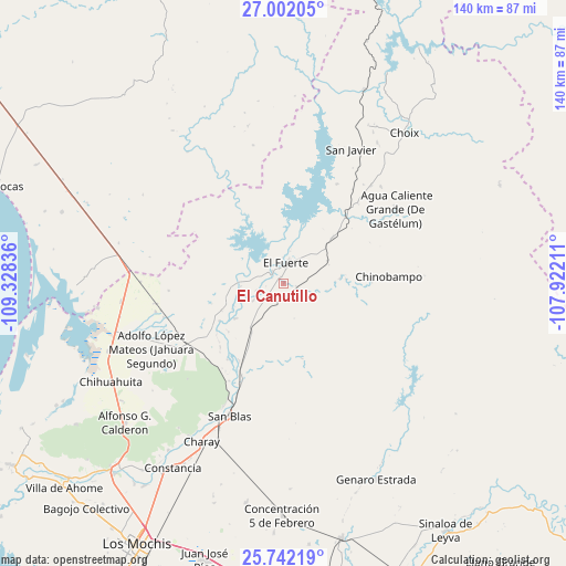
El Canutillo GPS coordinates[2]
26° 22' 25.824" North, 108° 37' 30.828" West
| Map corner | latitude | longitude |
|---|---|---|
| Upper-left | 27.00205°, | -109.32836° |
| Center: | 26.37384°, | -108.62523° |
| Lower-right: | 25.74219°, | -107.92211° |
| Map W x H: | 140.1×140.1 km | = 87.1×87.1mi |
| max Lat: | 32.7° ⇑4.3% North |
| El Canutillo: | 26.37384° |
| min Lat: | ⇓95.7% South 14.53588° |
| min Long | El Canutillo | max Long |
| -117.105° | -108.62523° | -86.73105° |
| W 3.5%⇐ | ⇒96.5% E |
Elevation
Elevation of El Canutillo is 93 m = 305 ft, and this is 1160.7 m = 3808 ft below average elevation for this country.
| Max E: |
3497 m = 11473 ft | 80.1% |
| Avg. | 1253.7 m = 4113 ft | |
| El Canutillo | 93 m = 305 ft | |
Min E: |
-1 m = -3 ft | 19.9% |
See also: Mexico elevation on elevation.city.
Geographical zone
El Canutillo is located in North temperate zone (between Tropic of Cancer and the Arctic Circle). Distance of this Northern Tropic circle is 326.6 km =202.9 mi to South.| Distance of | km | miles | from El Canutillo |
|---|---|---|---|
| North Pole | 7074.6 | 4396 | to North |
| Arctic Circle | 4468.7 | 2776.7 | to North |
| Tropic Cancer | 326.6 | 202.9 | to South |
| Equator | 2932.5 | 1822.2 | to South |


Nearby cities:
15 places around El Canutillo: (largest is in red/bold)
• Baroten
4.2 km =2.6 mi,  316°
316°
• Boca de Arroyo
14.3 km =8.9 mi,  243°
243°
• Chinobampo
26 km =16.2 mi,  86°
86°
• El Fuerte
4.8 km =3 mi,  8°
8°
• Estación Hoyancos (Estación el Fuerte)
3.2 km =2 mi,  103°
103°
• La Bajada del Monte
8.5 km =5.3 mi, 241°
• Las Estacas
18.4 km =11.4 mi,  228°
228°
• Los Capomos
12.2 km =7.6 mi,  62°
62°
• Lázaro Cárdenas
30.9 km =19.2 mi,  254°
254°
• Mulanjey
25.1 km =15.6 mi,  204°
204°
• Mulanjey (Estación Vega)
25.1 km =15.6 mi, 204°
• Palo Verde
31.2 km =19.4 mi,  257°
257°
• San Pedro
22.5 km =14 mi,  42°
42°
• Sibajahui
27.4 km =17 mi, 204°
• Tehueco
14.8 km =9.2 mi, 234°
Sources, notices
• [Note1] Compared only with cities in Mexico existing in our database
• [Src1] Map data: © OpenStreetMap contributors (CC-BY-SA)
• [Src2] Other city data from geonames.org with taken over terms of usage.
• [Src3] Geographical zone / Annual Mean Temperature by Robert A. Rohde @ Wikipedia
