La Yesca geodata
La Yesca (Nayarit) is a seat of a second-order administrative division; located in Mexico in America/Mazatlan (GMT-7) time zone. With population of 534 people, there are 15868 cities with bigger population in this country. Compared to other cities in Mexico, 80.2% of cities are located further ↓South; 90% of cities are located further →East and 50% of cities have lower elevation than La Yesca. Note1


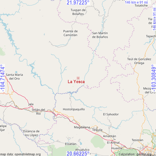
La Yesca GPS coordinates[2]
21° 19' 7.356" North, 104° 0' 41.796" West
| Map corner | latitude | longitude |
|---|---|---|
| Upper-left | 21.97225°, | -104.71474° |
| Center: | 21.31871°, | -104.01161° |
| Lower-right: | 20.66225°, | -103.30849° |
| Map W x H: | 145.7×145.7 km | = 90.5×90.5mi |
| max Lat: | 32.7° ⇑19.8% North |
| La Yesca: | 21.31871° |
| min Lat: | ⇓80.2% South 14.53588° |
| min Long | La Yesca | max Long |
| -117.105° | -104.01161° | -86.73105° |
| W 10%⇐ | ⇒90% E |
Elevation
Elevation of La Yesca is 1434 m = 4705 ft, and this is 180.3 m = 592 ft above average elevation for this country.
| Max E: |
3497 m = 11473 ft | 50% |
| La Yesca | 1434 m 4705 ft | |
| Avg. | 1253.7 m = 4113 ft | |
Min E: |
-1 m = -3 ft | 50% |
See also: Mexico elevation on elevation.city.
Geographical zone
La Yesca is located in North Torrid zone (between Equator and Tropic of Cancer). Distance of this Northern Tropic circle is 235.5 km =146.3 mi to North.| Distance of | km | miles | from La Yesca |
|---|---|---|---|
| North Pole | 7636.6 | 4745.2 | to North |
| Arctic Circle | 5030.8 | 3126 | to North |
| Tropic Cancer | 235.5 | 146.3 | to North |
| Equator | 2370.4 | 1472.9 | to South |


Nearby cities:
15 places around La Yesca: (largest is in red/bold)
• Apozolco
16.2 km =10.1 mi,  40°
40°
• El Llano de los Vela
36.8 km =22.9 mi,  164°
164°
• Francisco I. Madero (La Bolsa)
41.2 km =25.6 mi,  232°
232°
• Hostotipaquillo
29 km =18 mi,  188°
188°
• La Cofradía
39.9 km =24.8 mi, 233°
• La Mesa de Flores
16.8 km =10.4 mi,  209°
209°
• La Quemada
38.8 km =24.1 mi, 185°
• La Venta de Nochitiltic
36.2 km =22.5 mi,  202°
202°
• Los Aguajes
42.6 km =26.5 mi,  236°
236°
• Milpillas de Allende
41.1 km =25.5 mi,  88°
88°
• Puente de Camotlán
42.8 km =26.6 mi,  350°
350°
• Rosa Blanca
41.9 km =26 mi, 238°
• San Miguel de Buenavista
41.9 km =26 mi, 234°
• San Simón
36.6 km =22.7 mi,  179°
179°
• Santo Tomás
37.4 km =23.2 mi, 196°
Sources, notices
• [Note1] Compared only with cities in Mexico existing in our database
• [Src1] Map data: © OpenStreetMap contributors (CC-BY-SA)
• [Src2] Other city data from geonames.org with taken over terms of usage.
• [Src3] Geographical zone / Annual Mean Temperature by Robert A. Rohde @ Wikipedia
