Piñícuaro geodata
Piñícuaro (Guanajuato) is a populated place; located in Mexico in America/Mexico_City (GMT-6) time zone. With population of 1,026 people, there are 8492 cities with bigger population in this country. Compared to other cities in Mexico, 58% of cities are located further ↓South; 75.2% of cities are located further →East and 78.8% of cities have lower elevation than Piñícuaro. Note1


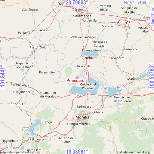
Piñícuaro GPS coordinates[2]
20° 2' 51.036" North, 101° 14' 27.492" West
| Map corner | latitude | longitude |
|---|---|---|
| Upper-left | 20.70663°, | -101.9441° |
| Center: | 20.04751°, | -101.24097° |
| Lower-right: | 19.38561°, | -100.53785° |
| Map W x H: | 146.9×146.9 km | = 91.3×91.3mi |
| max Lat: | 32.7° ⇑42% North |
| Piñícuaro: | 20.04751° |
| min Lat: | ⇓58% South 14.53588° |
| min Long | Piñícuaro | max Long |
| -117.105° | -101.24097° | -86.73105° |
| W 24.8%⇐ | ⇒75.2% E |
Elevation
Elevation of Piñícuaro is 2109 m = 6919 ft, and this is 855.3 m = 2806 ft above average elevation for this country.
| Max E: |
3497 m = 11473 ft | 21.2% |
| Piñícuaro | 2109 m 6919 ft | |
| Avg. | 1253.7 m = 4113 ft | |
Min E: |
-1 m = -3 ft | 78.8% |
See also: Mexico elevation on elevation.city.
Geographical zone
Piñícuaro is located in North Torrid zone (between Equator and Tropic of Cancer). Distance of this Northern Tropic circle is 376.8 km =234.1 mi to North.| Distance of | km | miles | from Piñícuaro |
|---|---|---|---|
| North Pole | 7778 | 4833 | to North |
| Arctic Circle | 5172.1 | 3213.8 | to North |
| Tropic Cancer | 376.8 | 234.1 | to North |
| Equator | 2229.1 | 1385.1 | to South |


Nearby cities:
15 places around Piñícuaro: (largest is in red/bold)
• Capacho
9.3 km =5.8 mi,  173°
173°
• Cerécuaro
10.9 km =6.8 mi,  271°
271°
• Chupícuaro
8.8 km =5.5 mi,  123°
123°
• Cuamio
9.4 km =5.8 mi,  99°
99°
• Cuaracurío
9.9 km =6.2 mi,  81°
81°
• El Moral
10.5 km =6.5 mi,  331°
331°
• El Salto
6.1 km =3.8 mi,  87°
87°
• Huandacareo
7.2 km =4.5 mi,  210°
210°
• Jéruco
11.3 km =7 mi,  138°
138°
• La Estancia
10.2 km =6.3 mi,  220°
220°
• La Ordeña
6.8 km =4.2 mi, 326°
• Moroleón
10.1 km =6.3 mi,  30°
30°
• Rinconadas del Bosque
6.1 km =3.8 mi,  46°
46°
• San José Cuaracurio
10.6 km =6.6 mi, 54°
• San José Cuaro
6.7 km =4.2 mi,  189°
189°
Sources, notices
• [Note1] Compared only with cities in Mexico existing in our database
• [Src1] Map data: © OpenStreetMap contributors (CC-BY-SA)
• [Src2] Other city data from geonames.org with taken over terms of usage.
• [Src3] Geographical zone / Annual Mean Temperature by Robert A. Rohde @ Wikipedia
