Moroleón geodata
Moroleón (Guanajuato) is a seat of a second-order administrative division; located in Mexico in America/Mexico_City (GMT-6) time zone. With population of 43,200 people, there are 244 cities with bigger population in this country. Compared to other cities in Mexico, 59.7% of cities are located further ↓South; 74.9% of cities are located further →East and 64.5% of cities have lower elevation than Moroleón. Note1


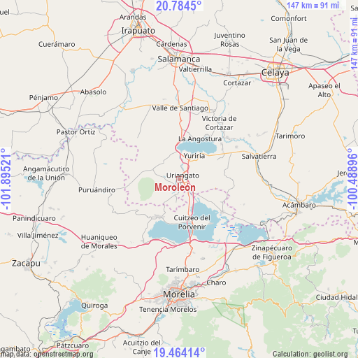
Moroleón GPS coordinates[2]
20° 7' 32.556" North, 101° 11' 31.488" West
| Map corner | latitude | longitude |
|---|---|---|
| Upper-left | 20.7845°, | -101.89521° |
| Center: | 20.12571°, | -101.19208° |
| Lower-right: | 19.46414°, | -100.48896° |
| Map W x H: | 146.8×146.8 km | = 91.2×91.2mi |
| max Lat: | 32.7° ⇑40.3% North |
| Moroleón: | 20.12571° |
| min Lat: | ⇓59.7% South 14.53588° |
| min Long | Moroleón | max Long |
| -117.105° | -101.19208° | -86.73105° |
| W 25.1%⇐ | ⇒74.9% E |
Elevation
Elevation of Moroleón is 1815 m = 5955 ft, and this is 561.3 m = 1842 ft above average elevation for this country.
| Max E: |
3497 m = 11473 ft | 35.5% |
| Moroleón | 1815 m 5955 ft | |
| Avg. | 1253.7 m = 4113 ft | |
Min E: |
-1 m = -3 ft | 64.5% |
See also: Moroleón elevation on elevation.city.
Geographical zone
Moroleón is located in North Torrid zone (between Equator and Tropic of Cancer). Distance of this Northern Tropic circle is 368.1 km =228.7 mi to North.| Distance of | km | miles | from Moroleón |
|---|---|---|---|
| North Pole | 7769.3 | 4827.6 | to North |
| Arctic Circle | 5163.4 | 3208.4 | to North |
| Tropic Cancer | 368.1 | 228.7 | to North |
| Equator | 2237.8 | 1390.5 | to South |


Nearby cities:
15 places around Moroleón: (largest is in red/bold)
• Colonia Juárez
5.1 km =3.2 mi,  65°
65°
• Cuaracurío
8.6 km =5.3 mi,  147°
147°
• El Charco
6.9 km =4.3 mi, 71°
• El Derramadero
8.3 km =5.2 mi,  126°
126°
• El Salto
8.5 km =5.3 mi,  173°
173°
• La Ordeña
9.3 km =5.8 mi,  251°
251°
• Las Misiones
4.5 km =2.8 mi,  30°
30°
• Monte de los Juárez
8.8 km =5.5 mi,  316°
316°
• Parangarico
7.9 km =4.9 mi,  20°
20°
• Piñícuaro
10.1 km =6.3 mi,  210°
210°
• Rinconadas del Bosque
4.5 km =2.8 mi,  188°
188°
• San Andrés Enguaro
9 km =5.6 mi,  328°
328°
• San José Cuaracurio
4.3 km =2.7 mi, 125°
• San Miguel el Alto (San Miguelito)
9.2 km =5.7 mi,  7°
7°
• Uriangato
2 km =1.2 mi, 30°
Sources, notices
• [Note1] Compared only with cities in Mexico existing in our database
• [Src1] Map data: © OpenStreetMap contributors (CC-BY-SA)
• [Src2] Other city data from geonames.org with taken over terms of usage.
• [Src3] Geographical zone / Annual Mean Temperature by Robert A. Rohde @ Wikipedia
