Los Guajes geodata
Los Guajes (Jalisco) is a populated place; located in Mexico in America/Mexico_City (GMT-6) time zone. With population of 705 people, there are 12337 cities with bigger population in this country. Compared to other cities in Mexico, 58.8% of cities are located further ↓South; 90% of cities are located further →East and 52.9% of cities have higher elevation than Los Guajes. Note1


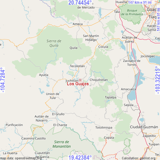
Los Guajes GPS coordinates[2]
20° 5' 8.088" North, 104° 1' 30.972" West
| Map corner | latitude | longitude |
|---|---|---|
| Upper-left | 20.74454°, | -104.7284° |
| Center: | 20.08558°, | -104.02527° |
| Lower-right: | 19.42384°, | -103.32215° |
| Map W x H: | 146.8×146.9 km | = 91.2×91.3mi |
| max Lat: | 32.7° ⇑41.2% North |
| Los Guajes: | 20.08558° |
| min Lat: | ⇓58.8% South 14.53588° |
| min Long | Los Guajes | max Long |
| -117.105° | -104.02527° | -86.73105° |
| W 10%⇐ | ⇒90% E |
Elevation
Elevation of Los Guajes is 1292 m = 4239 ft, and this is 38.3 m = 126 ft above average elevation for this country.
| Max E: |
3497 m = 11473 ft | 52.9% |
| Los Guajes | 1292 m 4239 ft | |
| Avg. | 1253.7 m = 4113 ft | |
Min E: |
-1 m = -3 ft | 47.1% |
See also: Mexico elevation on elevation.city.
Geographical zone
Los Guajes is located in North Torrid zone (between Equator and Tropic of Cancer). Distance of this Northern Tropic circle is 372.6 km =231.5 mi to North.| Distance of | km | miles | from Los Guajes |
|---|---|---|---|
| North Pole | 7773.8 | 4830.4 | to North |
| Arctic Circle | 5167.9 | 3211.2 | to North |
| Tropic Cancer | 372.6 | 231.5 | to North |
| Equator | 2233.3 | 1387.7 | to South |


Nearby cities:
15 places around Los Guajes: (largest is in red/bold)
• Ayotitlán
17.2 km =10.7 mi,  29°
29°
• Chiquilistlán
17.2 km =10.7 mi,  89°
89°
• Chiquilistlán
25.2 km =15.7 mi,  59°
59°
• Coatlancillo
22.3 km =13.9 mi,  163°
163°
• Cofradía de Duendes
16.6 km =10.3 mi,  7°
7°
• Colotitlán
13.4 km =8.3 mi,  274°
274°
• Ejutla
24.6 km =15.3 mi,  215°
215°
• Juanacatlán
26.6 km =16.5 mi,  296°
296°
• Juchitlán
7.7 km =4.8 mi, 269°
• La Ciénega
30 km =18.6 mi,  203°
203°
• San Clemente
23.6 km =14.7 mi, 269°
• Tamazulita
14.5 km =9 mi,  23°
23°
• Tecolotlán
13.1 km =8.1 mi,  349°
349°
• Tenamaxtlán
20.6 km =12.8 mi,  315°
315°
• Unión de Tula
29.1 km =18.1 mi,  240°
240°
Sources, notices
• [Note1] Compared only with cities in Mexico existing in our database
• [Src1] Map data: © OpenStreetMap contributors (CC-BY-SA)
• [Src2] Other city data from geonames.org with taken over terms of usage.
• [Src3] Geographical zone / Annual Mean Temperature by Robert A. Rohde @ Wikipedia
