Juchitlán geodata
Juchitlán (Jalisco) is a seat of a second-order administrative division; located in Mexico in America/Mexico_City (GMT-6) time zone. With population of 3,468 people, there are 2633 cities with bigger population in this country. Compared to other cities in Mexico, 58.8% of cities are located further ↓South; 90.3% of cities are located further →East and 53.9% of cities have higher elevation than Juchitlán. Note1


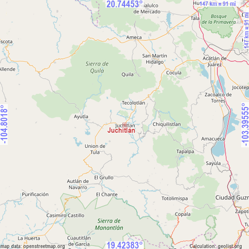
Juchitlán GPS coordinates[2]
20° 5' 8.052" North, 104° 5' 55.212" West
| Map corner | latitude | longitude |
|---|---|---|
| Upper-left | 20.74453°, | -104.8018° |
| Center: | 20.08557°, | -104.09867° |
| Lower-right: | 19.42383°, | -103.39555° |
| Map W x H: | 146.8×146.9 km | = 91.2×91.3mi |
| max Lat: | 32.7° ⇑41.2% North |
| Juchitlán: | 20.08557° |
| min Lat: | ⇓58.8% South 14.53588° |
| min Long | Juchitlán | max Long |
| -117.105° | -104.09867° | -86.73105° |
| W 9.7%⇐ | ⇒90.3% E |
Elevation
Elevation of Juchitlán is 1250 m = 4101 ft, and this is 3.7 m = 12 ft below average elevation for this country.
| Max E: |
3497 m = 11473 ft | 53.9% |
| Avg. | 1253.7 m = 4113 ft | |
| Juchitlán | 1250 m = 4101 ft | |
Min E: |
-1 m = -3 ft | 46.1% |
See also: Mexico elevation on elevation.city.
Geographical zone
Juchitlán is located in North Torrid zone (between Equator and Tropic of Cancer). Distance of this Northern Tropic circle is 372.6 km =231.5 mi to North.| Distance of | km | miles | from Juchitlán |
|---|---|---|---|
| North Pole | 7773.8 | 4830.4 | to North |
| Arctic Circle | 5167.9 | 3211.2 | to North |
| Tropic Cancer | 372.6 | 231.5 | to North |
| Equator | 2233.3 | 1387.7 | to South |


Nearby cities:
15 places around Juchitlán: (largest is in red/bold)
• Atengo
25.5 km =15.8 mi,  325°
325°
• Ayotitlán
22 km =13.7 mi,  47°
47°
• Ayutla
26 km =16.2 mi,  280°
280°
• Chiquilistlán
24.9 km =15.5 mi,  89°
89°
• Coatlancillo
25.5 km =15.8 mi,  146°
146°
• Cofradía de Duendes
19.2 km =11.9 mi,  30°
30°
• Colotitlán
5.8 km =3.6 mi, 281°
• Ejutla
21.1 km =13.1 mi,  198°
198°
• Juanacatlán
20 km =12.4 mi,  305°
305°
• Los Guajes
7.7 km =4.8 mi, 89°
• San Clemente
16 km =9.9 mi,  269°
269°
• Tamazulita
18.9 km =11.7 mi, 45°
• Tecolotlán
14 km =8.7 mi,  22°
22°
• Tenamaxtlán
16.2 km =10.1 mi, 334°
• Unión de Tula
22.8 km =14.2 mi,  230°
230°
Sources, notices
• [Note1] Compared only with cities in Mexico existing in our database
• [Src1] Map data: © OpenStreetMap contributors (CC-BY-SA)
• [Src2] Other city data from geonames.org with taken over terms of usage.
• [Src3] Geographical zone / Annual Mean Temperature by Robert A. Rohde @ Wikipedia
