Cofradía de Duendes geodata
Cofradía de Duendes (Jalisco) is a populated place; located in Mexico in America/Mexico_City (GMT-6) time zone. With population of 504 people, there are 16693 cities with bigger population in this country. Compared to other cities in Mexico, 62.1% of cities are located further ↓South; 90% of cities are located further →East and 53.6% of cities have higher elevation than Cofradía de Duendes. Note1


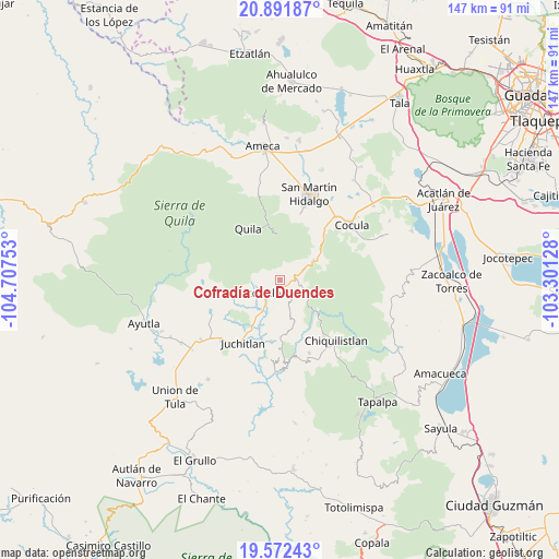
Cofradía de Duendes GPS coordinates[2]
20° 14' 0.78" North, 104° 0' 15.84" West
| Map corner | latitude | longitude |
|---|---|---|
| Upper-left | 20.89187°, | -104.70753° |
| Center: | 20.23355°, | -104.0044° |
| Lower-right: | 19.57243°, | -103.30128° |
| Map W x H: | 146.7×146.7 km | = 91.2×91.2mi |
| max Lat: | 32.7° ⇑37.9% North |
| Cofradía de Duendes: | 20.23355° |
| min Lat: | ⇓62.1% South 14.53588° |
| min Long | Cofradía de Du | max Long |
| -117.105° | -104.0044° | -86.73105° |
| W 10%⇐ | ⇒90% E |
Elevation
Elevation of Cofradía de Duendes is 1266 m = 4154 ft, and this is 12.3 m = 40 ft above average elevation for this country.
| Max E: |
3497 m = 11473 ft | 53.6% |
| Cofradía de Duendes | 1266 m 4154 ft | |
| Avg. | 1253.7 m = 4113 ft | |
Min E: |
-1 m = -3 ft | 46.4% |
See also: Mexico elevation on elevation.city.
Geographical zone
Cofradía de Duendes is located in North Torrid zone (between Equator and Tropic of Cancer). Distance of this Northern Tropic circle is 356.2 km =221.3 mi to North.| Distance of | km | miles | from Cofradía de Duendes |
|---|---|---|---|
| North Pole | 7757.3 | 4820.2 | to North |
| Arctic Circle | 5151.4 | 3200.9 | to North |
| Tropic Cancer | 356.2 | 221.3 | to North |
| Equator | 2249.8 | 1398 | to South |


Nearby cities:
15 places around Cofradía de Duendes: (largest is in red/bold)
• Ayotitlán
6.5 km =4 mi,  102°
102°
• Chiquilistlán
19.9 km =12.4 mi, 100°
• Chiquilistlán
22.1 km =13.7 mi,  137°
137°
• Cocula
24 km =14.9 mi,  52°
52°
• Colotitlán
21.8 km =13.5 mi,  225°
225°
• El Crucero de Santa María
22.3 km =13.9 mi,  41°
41°
• Ipazoltic
22.5 km =14 mi,  4°
4°
• Juchitlán
19.2 km =11.9 mi,  210°
210°
• Los Guajes
16.6 km =10.3 mi,  187°
187°
• San Martín Hidalgo
23.8 km =14.8 mi,  19°
19°
• Santa Cruz de las Flores
18.8 km =11.7 mi, 17°
• Santa María
24.5 km =15.2 mi, 40°
• Tamazulita
4.9 km =3 mi,  131°
131°
• Tecolotlán
5.7 km =3.5 mi, 231°
• Tenamaxtlán
16.8 km =10.4 mi,  263°
263°
Sources, notices
• [Note1] Compared only with cities in Mexico existing in our database
• [Src1] Map data: © OpenStreetMap contributors (CC-BY-SA)
• [Src2] Other city data from geonames.org with taken over terms of usage.
• [Src3] Geographical zone / Annual Mean Temperature by Robert A. Rohde @ Wikipedia
