La Sauceda geodata
La Sauceda (Michoacán) is a populated place; located in Mexico in America/Mexico_City (GMT-6) time zone. With population of 3,069 people, there are 2936 cities with bigger population in this country. Compared to other cities in Mexico, 59% of cities are located further ↓South; 83.2% of cities are located further →East and 54.6% of cities have lower elevation than La Sauceda. Note1


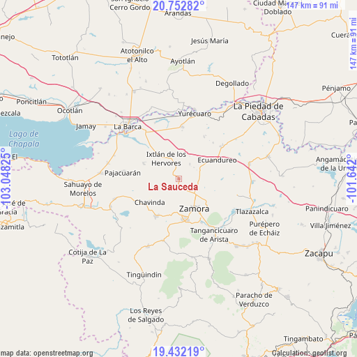
La Sauceda GPS coordinates[2]
20° 5' 38.04" North, 102° 20' 42.432" West
| Map corner | latitude | longitude |
|---|---|---|
| Upper-left | 20.75282°, | -103.04825° |
| Center: | 20.0939°, | -102.34512° |
| Lower-right: | 19.43219°, | -101.642° |
| Map W x H: | 146.8×146.8 km | = 91.2×91.2mi |
| max Lat: | 32.7° ⇑41% North |
| La Sauceda: | 20.0939° |
| min Lat: | ⇓59% South 14.53588° |
| min Long | La Sauceda | max Long |
| -117.105° | -102.34512° | -86.73105° |
| W 16.8%⇐ | ⇒83.2% E |
Elevation
Elevation of La Sauceda is 1575 m = 5167 ft, and this is 321.3 m = 1054 ft above average elevation for this country.
| Max E: |
3497 m = 11473 ft | 45.4% |
| La Sauceda | 1575 m 5167 ft | |
| Avg. | 1253.7 m = 4113 ft | |
Min E: |
-1 m = -3 ft | 54.6% |
See also: Mexico elevation on elevation.city.
Geographical zone
La Sauceda is located in North Torrid zone (between Equator and Tropic of Cancer). Distance of this Northern Tropic circle is 371.7 km =231 mi to North.| Distance of | km | miles | from La Sauceda |
|---|---|---|---|
| North Pole | 7772.8 | 4829.8 | to North |
| Arctic Circle | 5166.9 | 3210.6 | to North |
| Tropic Cancer | 371.7 | 231 | to North |
| Equator | 2234.2 | 1388.3 | to South |


Nearby cities:
15 places around La Sauceda: (largest is in red/bold)
• Ario de Rayón
7.5 km =4.7 mi,  182°
182°
• El Cerrito de Catipuato (Cerrito de Ortiz)
9.6 km =6 mi,  136°
136°
• El Colesio
7.6 km =4.7 mi,  37°
37°
• El Colongo
3 km =1.9 mi,  290°
290°
• El Limón
9 km =5.6 mi,  310°
310°
• El Llano
7.9 km =4.9 mi,  206°
206°
• El Salitre
8.7 km =5.4 mi,  339°
339°
• El Sauz de Abajo
8.3 km =5.2 mi,  104°
104°
• El Tepehuaje
6.1 km =3.8 mi,  245°
245°
• Ixtlán de los Hervores
9.8 km =6.1 mi,  328°
328°
• La Esperanza
8.1 km =5 mi,  238°
238°
• La Estanzuela
3.8 km =2.4 mi,  317°
317°
• La Plaza del Limón
10.1 km =6.3 mi,  297°
297°
• La Rinconoda
8.1 km =5 mi,  133°
133°
• Rincón del Mezquite
7.8 km =4.8 mi,  269°
269°
Sources, notices
• [Note1] Compared only with cities in Mexico existing in our database
• [Src1] Map data: © OpenStreetMap contributors (CC-BY-SA)
• [Src2] Other city data from geonames.org with taken over terms of usage.
• [Src3] Geographical zone / Annual Mean Temperature by Robert A. Rohde @ Wikipedia
