La Plaza del Limón geodata
La Plaza del Limón (Michoacán) is a populated place; located in Mexico in America/Mexico_City (GMT-6) time zone. With population of 1,905 people, there are 4566 cities with bigger population in this country. Compared to other cities in Mexico, 59.9% of cities are located further ↓South; 83.7% of cities are located further →East and 52.9% of cities have lower elevation than La Plaza del Limón. Note1


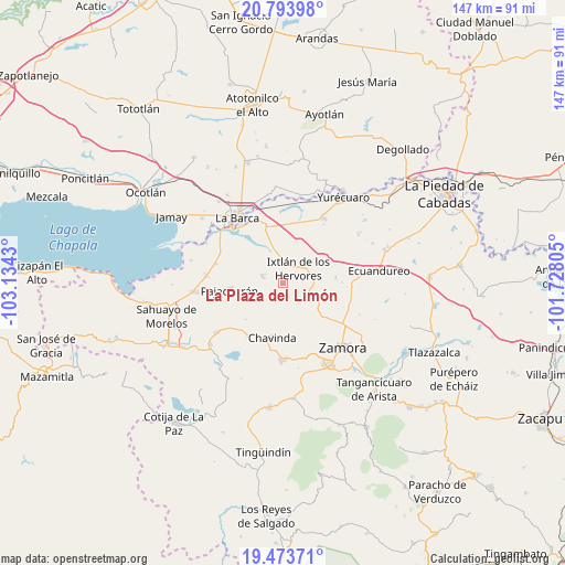
La Plaza del Limón GPS coordinates[2]
20° 8' 6.864" North, 102° 25' 52.212" West
| Map corner | latitude | longitude |
|---|---|---|
| Upper-left | 20.79398°, | -103.1343° |
| Center: | 20.13524°, | -102.43117° |
| Lower-right: | 19.47371°, | -101.72805° |
| Map W x H: | 146.8×146.8 km | = 91.2×91.2mi |
| max Lat: | 32.7° ⇑40.1% North |
| La Plaza del Limón: | 20.13524° |
| min Lat: | ⇓59.9% South 14.53588° |
| min Long | La Plaza del Li | max Long |
| -117.105° | -102.43117° | -86.73105° |
| W 16.3%⇐ | ⇒83.7% E |
Elevation
Elevation of La Plaza del Limón is 1540 m = 5052 ft, and this is 286.3 m = 939 ft above average elevation for this country.
| Max E: |
3497 m = 11473 ft | 47.1% |
| La Plaza del Limón | 1540 m 5052 ft | |
| Avg. | 1253.7 m = 4113 ft | |
Min E: |
-1 m = -3 ft | 52.9% |
See also: Mexico elevation on elevation.city.
Geographical zone
La Plaza del Limón is located in North Torrid zone (between Equator and Tropic of Cancer). Distance of this Northern Tropic circle is 367.1 km =228.1 mi to North.| Distance of | km | miles | from La Plaza del Limón |
|---|---|---|---|
| North Pole | 7768.2 | 4826.9 | to North |
| Arctic Circle | 5162.3 | 3207.7 | to North |
| Tropic Cancer | 367.1 | 228.1 | to North |
| Equator | 2238.8 | 1391.1 | to South |


Nearby cities:
15 places around La Plaza del Limón: (largest is in red/bold)
• Camucuato
4.3 km =2.7 mi,  1°
1°
• El Colongo
7.2 km =4.5 mi,  119°
119°
• El Limón
2.4 km =1.5 mi,  59°
59°
• El Paracho
10 km =6.2 mi,  252°
252°
• El Salitre
6.9 km =4.3 mi, 58°
• El Tepehuaje
7.9 km =4.9 mi,  154°
154°
• El Valenciano
3.1 km =1.9 mi,  299°
299°
• Ixtlán de los Hervores
5.3 km =3.3 mi,  45°
45°
• La Angostura
6.9 km =4.3 mi,  350°
350°
• La Cuestita
10 km =6.2 mi,  218°
218°
• La Esperanza
9.1 km =5.7 mi,  166°
166°
• La Estanzuela
6.7 km =4.2 mi,  105°
105°
• La Luz
6 km =3.7 mi,  288°
288°
• Rincón del Mezquite
4.8 km =3 mi, 165°
• Tecomatán
7.2 km =4.5 mi, 251°
Sources, notices
• [Note1] Compared only with cities in Mexico existing in our database
• [Src1] Map data: © OpenStreetMap contributors (CC-BY-SA)
• [Src2] Other city data from geonames.org with taken over terms of usage.
• [Src3] Geographical zone / Annual Mean Temperature by Robert A. Rohde @ Wikipedia
