La Perla geodata
La Perla (Chihuahua) is a populated place; located in Mexico in America/Chihuahua (GMT-6) time zone. With population of 943 people, there are 9232 cities with bigger population in this country. Compared to other cities in Mexico, 97.6% of cities are located further ↓South; 91.1% of cities are located further →East and 54.9% of cities have lower elevation than La Perla. Note1


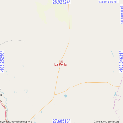
La Perla GPS coordinates[2]
28° 18' 21.6" North, 104° 32' 57.948" West
| Map corner | latitude | longitude |
|---|---|---|
| Upper-left | 28.92324°, | -105.25256° |
| Center: | 28.306°, | -104.54943° |
| Lower-right: | 27.68516°, | -103.84631° |
| Map W x H: | 137.7×137.7 km | = 85.6×85.6mi |
| max Lat: | 32.7° ⇑2.4% North |
| La Perla: | 28.306° |
| min Lat: | ⇓97.6% South 14.53588° |
| min Long | La Perla | max Long |
| -117.105° | -104.54943° | -86.73105° |
| W 8.9%⇐ | ⇒91.1% E |
Elevation
Elevation of La Perla is 1587 m = 5207 ft, and this is 333.3 m = 1094 ft above average elevation for this country.
| Max E: |
3497 m = 11473 ft | 45.1% |
| La Perla | 1587 m 5207 ft | |
| Avg. | 1253.7 m = 4113 ft | |
Min E: |
-1 m = -3 ft | 54.9% |
See also: Mexico elevation on elevation.city.
Geographical zone
La Perla is located in North temperate zone (between Tropic of Cancer and the Arctic Circle). Distance of this Northern Tropic circle is 541.4 km =336.4 mi to South.| Distance of | km | miles | from La Perla |
|---|---|---|---|
| North Pole | 6859.7 | 4262.4 | to North |
| Arctic Circle | 4253.8 | 2643.2 | to North |
| Tropic Cancer | 541.4 | 336.4 | to South |
| Equator | 3147.3 | 1955.6 | to South |


Nearby cities:
15 places around La Perla: (largest is in red/bold)
• Alvareñas
79.9 km =49.6 mi,  255°
255°
• Colonia Vicente Guerrero
80.9 km =50.3 mi,  248°
248°
• Corraleño
81.9 km =50.9 mi,  227°
227°
• Estación Conchos
81.4 km =50.6 mi,  242°
242°
• Estación Saucillo
81.5 km =50.6 mi, 247°
• Estación la Cruz
82.3 km =51.1 mi, 229°
• Hércules
79.9 km =49.6 mi,  111°
111°
• Jiménez
83.3 km =51.8 mi,  272°
272°
• La Cruz
80.3 km =49.9 mi, 232°
• Las Varas
79.3 km =49.3 mi, 257°
• Loma Chica
80.6 km =50.1 mi, 254°
• Orranteño
78.4 km =48.7 mi, 259°
• Parritas
75.7 km =47 mi, 242°
• Saucillo
79.1 km =49.2 mi, 247°
• Valle del Toro
76.7 km =47.7 mi, 239°
Sources, notices
• [Note1] Compared only with cities in Mexico existing in our database
• [Src1] Map data: © OpenStreetMap contributors (CC-BY-SA)
• [Src2] Other city data from geonames.org with taken over terms of usage.
• [Src3] Geographical zone / Annual Mean Temperature by Robert A. Rohde @ Wikipedia
