Hércules geodata
Hércules (Coahuila) is a populated place; located in Mexico in America/Monterrey (GMT-6) time zone. With population of 3,914 people, there are 2335 cities with bigger population in this country. Compared to other cities in Mexico, 97.3% of cities are located further ↓South; 89.4% of cities are located further →East and 52% of cities have higher elevation than Hércules. Note1


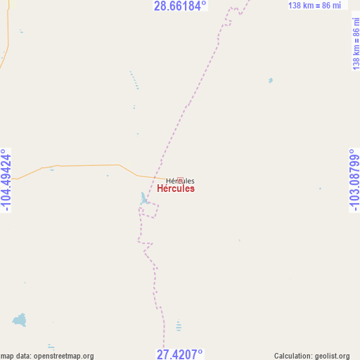
Hércules GPS coordinates[2]
28° 2' 35.016" North, 103° 47' 27.996" West
| Map corner | latitude | longitude |
|---|---|---|
| Upper-left | 28.66184°, | -104.49424° |
| Center: | 28.04306°, | -103.79111° |
| Lower-right: | 27.4207°, | -103.08799° |
| Map W x H: | 138×138 km | = 85.7×85.7mi |
| max Lat: | 32.7° ⇑2.7% North |
| Hércules: | 28.04306° |
| min Lat: | ⇓97.3% South 14.53588° |
| min Long | Hércules | max Long |
| -117.105° | -103.79111° | -86.73105° |
| W 10.6%⇐ | ⇒89.4% E |
Elevation
Elevation of Hércules is 1341 m = 4400 ft, and this is 87.3 m = 286 ft above average elevation for this country.
| Max E: |
3497 m = 11473 ft | 52% |
| Hércules | 1341 m 4400 ft | |
| Avg. | 1253.7 m = 4113 ft | |
Min E: |
-1 m = -3 ft | 48% |
See also: Mexico elevation on elevation.city.
Geographical zone
Hércules is located in North temperate zone (between Tropic of Cancer and the Arctic Circle). Distance of this Northern Tropic circle is 512.2 km =318.3 mi to South.| Distance of | km | miles | from Hércules |
|---|---|---|---|
| North Pole | 6889 | 4280.6 | to North |
| Arctic Circle | 4283.1 | 2661.4 | to North |
| Tropic Cancer | 512.2 | 318.3 | to South |
| Equator | 3118.1 | 1937.5 | to South |


Nearby cities:
15 places around Hércules: (largest is in red/bold)
• Alta Vista
142.9 km =88.8 mi,  255°
255°
• Camargo
141.6 km =88 mi,  253°
253°
• Chula Vista
119.1 km =74 mi,  159°
159°
• Corraleño
137.7 km =85.6 mi, 259°
• Estación la Cruz
139.4 km =86.6 mi, 260°
• La Cruz
139.4 km =86.6 mi, 261°
• La Esmeralda
85 km =52.8 mi,  171°
171°
• La Perla
79.9 km =49.6 mi,  291°
291°
• Laguna del Rey (Químicas del Rey)
120.1 km =74.6 mi, 159°
• Manuel Benavides
118.9 km =73.9 mi,  354°
354°
• Parritas
141.7 km =88 mi,  267°
267°
• San Carlos
118.8 km =73.8 mi, 354°
• San Ignacio
141 km =87.6 mi, 256°
• Sierra Mojada
84.4 km =52.4 mi, 173°
• Valle del Toro
141.1 km =87.7 mi, 266°
Sources, notices
• [Note1] Compared only with cities in Mexico existing in our database
• [Src1] Map data: © OpenStreetMap contributors (CC-BY-SA)
• [Src2] Other city data from geonames.org with taken over terms of usage.
• [Src3] Geographical zone / Annual Mean Temperature by Robert A. Rohde @ Wikipedia
