Escalón geodata
Escalón (Durango) is a populated place; located in Mexico in America/Chihuahua (GMT-6) time zone. With population of 697 people, there are 12494 cities with bigger population in this country. Compared to other cities in Mexico, 96% of cities are located further ↓South; 90.7% of cities are located further →East and 53.7% of cities have higher elevation than Escalón. Note1


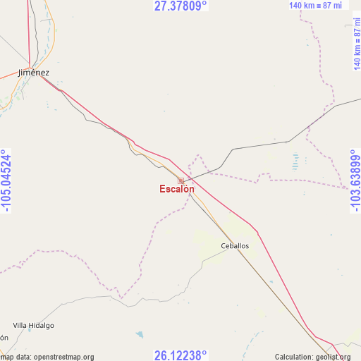
Escalón GPS coordinates[2]
26° 45' 7.092" North, 104° 20' 31.596" West
| Map corner | latitude | longitude |
|---|---|---|
| Upper-left | 27.37809°, | -105.04524° |
| Center: | 26.75197°, | -104.34211° |
| Lower-right: | 26.12238°, | -103.63899° |
| Map W x H: | 139.6×139.6 km | = 86.7×86.7mi |
| max Lat: | 32.7° ⇑4% North |
| Escalón: | 26.75197° |
| min Lat: | ⇓96% South 14.53588° |
| min Long | Escalón | max Long |
| -117.105° | -104.34211° | -86.73105° |
| W 9.3%⇐ | ⇒90.7% E |
Elevation
Elevation of Escalón is 1261 m = 4137 ft, and this is 7.3 m = 24 ft above average elevation for this country.
| Max E: |
3497 m = 11473 ft | 53.7% |
| Escalón | 1261 m 4137 ft | |
| Avg. | 1253.7 m = 4113 ft | |
Min E: |
-1 m = -3 ft | 46.3% |
See also: Mexico elevation on elevation.city.
Geographical zone
Escalón is located in North temperate zone (between Tropic of Cancer and the Arctic Circle). Distance of this Northern Tropic circle is 368.6 km =229 mi to South.| Distance of | km | miles | from Escalón |
|---|---|---|---|
| North Pole | 7032.5 | 4369.8 | to North |
| Arctic Circle | 4426.6 | 2750.6 | to North |
| Tropic Cancer | 368.6 | 229 | to South |
| Equator | 2974.5 | 1848.3 | to South |


Nearby cities:
15 places around Escalón: (largest is in red/bold)
• Ceballos
32.8 km =20.4 mi,  139°
139°
• Chula Vista
102 km =63.4 mi,  71°
71°
• Coronado
81.1 km =50.4 mi,  268°
268°
• José Esteban Coronado
81.1 km =50.4 mi, 268°
• José Mariano Jiménez
71.4 km =44.4 mi,  306°
306°
• La Esmeralda
89.8 km =55.8 mi,  48°
48°
• Laguna del Rey (Químicas del Rey)
101.6 km =63.1 mi, 72°
• López
74.1 km =46 mi,  292°
292°
• Octaviano López
74 km =46 mi, 292°
• Pueblito de Allende
101.2 km =62.9 mi, 285°
• Revolución
95.4 km =59.3 mi,  230°
230°
• Santa María
72.7 km =45.2 mi, 294°
• Sierra Mojada
87.1 km =54.1 mi, 46°
• Torreón de Cañas
101.7 km =63.2 mi,  245°
245°
• Villa Hidalgo
79.9 km =49.6 mi, 225°
Sources, notices
• [Note1] Compared only with cities in Mexico existing in our database
• [Src1] Map data: © OpenStreetMap contributors (CC-BY-SA)
• [Src2] Other city data from geonames.org with taken over terms of usage.
• [Src3] Geographical zone / Annual Mean Temperature by Robert A. Rohde @ Wikipedia
