La Esmeralda geodata
La Esmeralda (Coahuila) is a populated place; located in Mexico in America/Monterrey (GMT-6) time zone. With population of 1,111 people, there are 7820 cities with bigger population in this country. Compared to other cities in Mexico, 96.7% of cities are located further ↓South; 88.9% of cities are located further →East and 50.6% of cities have higher elevation than La Esmeralda. Note1


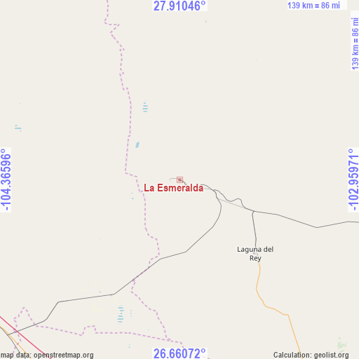
La Esmeralda GPS coordinates[2]
27° 17' 14.46" North, 103° 39' 46.188" West
| Map corner | latitude | longitude |
|---|---|---|
| Upper-left | 27.91046°, | -104.36596° |
| Center: | 27.28735°, | -103.66283° |
| Lower-right: | 26.66072°, | -102.95971° |
| Map W x H: | 139×139 km | = 86.4×86.4mi |
| max Lat: | 32.7° ⇑3.3% North |
| La Esmeralda: | 27.28735° |
| min Lat: | ⇓96.7% South 14.53588° |
| min Long | La Esmeralda | max Long |
| -117.105° | -103.66283° | -86.73105° |
| W 11.1%⇐ | ⇒88.9% E |
Elevation
Elevation of La Esmeralda is 1397 m = 4583 ft, and this is 143.3 m = 470 ft above average elevation for this country.
| Max E: |
3497 m = 11473 ft | 50.6% |
| La Esmeralda | 1397 m 4583 ft | |
| Avg. | 1253.7 m = 4113 ft | |
Min E: |
-1 m = -3 ft | 49.4% |
See also: Mexico elevation on elevation.city.
Geographical zone
La Esmeralda is located in North temperate zone (between Tropic of Cancer and the Arctic Circle). Distance of this Northern Tropic circle is 428.1 km =266 mi to South.| Distance of | km | miles | from La Esmeralda |
|---|---|---|---|
| North Pole | 6973 | 4332.8 | to North |
| Arctic Circle | 4367.1 | 2713.6 | to North |
| Tropic Cancer | 428.1 | 266 | to South |
| Equator | 3034.1 | 1885.3 | to South |


Nearby cities:
15 places around La Esmeralda: (largest is in red/bold)
• Ceballos
96.5 km =60 mi,  208°
208°
• Chula Vista
40.2 km =25 mi,  133°
133°
• Escalón
89.8 km =55.8 mi,  228°
228°
• Finisterre
151.2 km =94 mi,  163°
163°
• Hércules
85 km =52.8 mi,  351°
351°
• José Mariano Jiménez
125.9 km =78.2 mi,  262°
262°
• La Perla
142.9 km =88.8 mi,  322°
322°
• Laguna del Rey (Químicas del Rey)
40.9 km =25.4 mi, 134°
• López
139.4 km =86.6 mi, 256°
• Ocampo
125.1 km =77.7 mi,  88°
88°
• Octaviano López
139.2 km =86.5 mi, 256°
• Pamplona
134.2 km =83.4 mi,  168°
168°
• Santa María
136.5 km =84.8 mi, 257°
• Sierra Mojada
3.8 km =2.4 mi,  272°
272°
• Tlahualilo de Zaragoza
133.2 km =82.8 mi, 170°
Sources, notices
• [Note1] Compared only with cities in Mexico existing in our database
• [Src1] Map data: © OpenStreetMap contributors (CC-BY-SA)
• [Src2] Other city data from geonames.org with taken over terms of usage.
• [Src3] Geographical zone / Annual Mean Temperature by Robert A. Rohde @ Wikipedia
