Laguna del Rey (Químicas del Rey) geodata
Laguna del Rey (Químicas del Rey) (Coahuila) is a populated place; located in Mexico in America/Monterrey (GMT-6) time zone. With population of 2,651 people, there are 3330 cities with bigger population in this country. Compared to other cities in Mexico, 96.4% of cities are located further ↓South; 87.6% of cities are located further →East and 59.1% of cities have higher elevation than Laguna del Rey (Químicas del Rey). Note1
Current local time in Laguna del Rey (Químicas del Rey):
12:33 PM, MondayDifference from your time zone: hours


Laguna del Rey (Químicas del Rey) GPS coordinates[2]
27° 1' 50.016" North, 103° 22' 0.012" West
| Map corner | latitude | longitude |
|---|---|---|
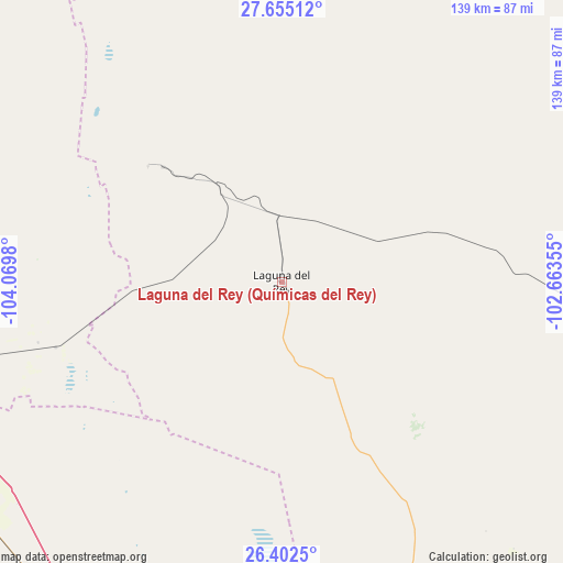
| Upper-left | 27.65512°, | -104.0698° |
| Center: | 27.03056°, | -103.36667° |
| Lower-right: | 26.4025°, | -102.66355° |
| Map W x H: | 139.3×139.3 km | = 86.6×86.6mi |
| max Lat: | 32.7° ⇑3.6% North |
| Laguna del Rey (Químicas del Rey): | 27.03056° |
| min Lat: | ⇓96.4% South 14.53588° |
| min Long | Laguna del Rey | max Long |
| -117.105° | -103.36667° | -86.73105° |
| W 12.4%⇐ | ⇒87.6% E |
Elevation
Elevation of Laguna del Rey (Químicas del Rey) is 1047 m = 3435 ft, and this is 206.7 m = 678 ft below average elevation for this country.
| Max E: |
3497 m = 11473 ft | 59.1% |
| Avg. | 1253.7 m = 4113 ft | |
| Laguna del Rey (Químicas del Rey) | 1047 m = 3435 ft | |
Min E: |
-1 m = -3 ft | 40.9% |
See also: Mexico elevation on elevation.city.
Geographical zone
Laguna del Rey (Químicas del Rey) is located in North temperate zone (between Tropic of Cancer and the Arctic Circle). Distance of this Northern Tropic circle is 399.6 km =248.3 mi to South.| Distance of | km | miles | from Laguna del Rey (Químicas del Rey) |
|---|---|---|---|
| North Pole | 7001.5 | 4350.5 | to North |
| Arctic Circle | 4395.7 | 2731.4 | to North |
| Tropic Cancer | 399.6 | 248.3 | to South |
| Equator | 3005.5 | 1867.5 | to South |


Nearby cities:
15 places around Laguna del Rey (Químicas del Rey): (largest is in red/bold)
• Ceballos
94.3 km =58.6 mi,  233°
233°
• Chula Vista
1.1 km =0.7 mi,  2°
2°
• Covadonga
123.5 km =76.7 mi,  174°
174°
• Escalón
101.6 km =63.1 mi,  252°
252°
• Finisterre
117 km =72.7 mi, 172°
• Hércules
120.1 km =74.6 mi,  339°
339°
• Jauja
122.5 km =76.1 mi,  180°
180°
• La Esmeralda
40.9 km =25.4 mi,  314°
314°
• Ocampo
101 km =62.8 mi,  71°
71°
• Pamplona
103.1 km =64.1 mi, 181°
• San Francisco de Horizonte (Horizonte)
121.7 km =75.6 mi, 182°
• San Julio
121.8 km =75.7 mi, 182°
• Sierra Mojada
43.8 km =27.2 mi, 310°
• Sofía de Arriba
123.1 km =76.5 mi, 170°
• Tlahualilo de Zaragoza
103.1 km =64.1 mi, 184°
Sources, notices
• [Note1] Compared only with cities in Mexico existing in our database
• [Src1] Map data: © OpenStreetMap contributors (CC-BY-SA)
• [Src2] Other city data from geonames.org with taken over terms of usage.
• [Src3] Geographical zone / Annual Mean Temperature by Robert A. Rohde @ Wikipedia
