El Derramadero geodata
El Derramadero (Guanajuato) is a populated place; located in Mexico in America/Mexico_City (GMT-6) time zone. With population of 919 people, there are 9500 cities with bigger population in this country. Compared to other cities in Mexico, 58.7% of cities are located further ↓South; 74.5% of cities are located further →East and 65.6% of cities have lower elevation than El Derramadero. Note1


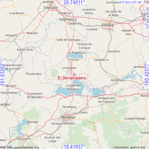
El Derramadero GPS coordinates[2]
20° 4' 52.068" North, 101° 7' 44.004" West
| Map corner | latitude | longitude |
|---|---|---|
| Upper-left | 20.74011°, | -101.83202° |
| Center: | 20.08113°, | -101.12889° |
| Lower-right: | 19.41937°, | -100.42577° |
| Map W x H: | 146.9×146.9 km | = 91.3×91.3mi |
| max Lat: | 32.7° ⇑41.3% North |
| El Derramadero: | 20.08113° |
| min Lat: | ⇓58.7% South 14.53588° |
| min Long | El Derramadero | max Long |
| -117.105° | -101.12889° | -86.73105° |
| W 25.5%⇐ | ⇒74.5% E |
Elevation
Elevation of El Derramadero is 1844 m = 6050 ft, and this is 590.3 m = 1937 ft above average elevation for this country.
| Max E: |
3497 m = 11473 ft | 34.4% |
| El Derramadero | 1844 m 6050 ft | |
| Avg. | 1253.7 m = 4113 ft | |
Min E: |
-1 m = -3 ft | 65.6% |
See also: Mexico elevation on elevation.city.
Geographical zone
El Derramadero is located in North Torrid zone (between Equator and Tropic of Cancer). Distance of this Northern Tropic circle is 373.1 km =231.8 mi to North.| Distance of | km | miles | from El Derramadero |
|---|---|---|---|
| North Pole | 7774.2 | 4830.7 | to North |
| Arctic Circle | 5168.4 | 3211.5 | to North |
| Tropic Cancer | 373.1 | 231.8 | to North |
| Equator | 2232.8 | 1387.4 | to South |


Nearby cities:
15 places around El Derramadero: (largest is in red/bold)
• Chupícuaro
9.6 km =6 mi,  206°
206°
• Colonia Juárez
7.3 km =4.5 mi,  344°
344°
• Cuamio
5.8 km =3.6 mi,  204°
204°
• Cuaracurío
3 km =1.9 mi,  221°
221°
• El Charco
7.1 km =4.4 mi,  359°
359°
• El Salteador
8.4 km =5.2 mi,  39°
39°
• El Salto
6.6 km =4.1 mi,  238°
238°
• El Timbinal
8.5 km =5.3 mi,  80°
80°
• La Lobera
8 km =5 mi,  123°
123°
• Las Misiones
9.8 km =6.1 mi,  334°
334°
• Moroleón
8.3 km =5.2 mi,  306°
306°
• Rinconadas del Bosque
7.3 km =4.5 mi,  273°
273°
• San José Cuaracurio
3.9 km =2.4 mi, 308°
• San Rafael del Carrizal
4.5 km =2.8 mi, 117°
• Uriangato
8.7 km =5.4 mi,  319°
319°
Sources, notices
• [Note1] Compared only with cities in Mexico existing in our database
• [Src1] Map data: © OpenStreetMap contributors (CC-BY-SA)
• [Src2] Other city data from geonames.org with taken over terms of usage.
• [Src3] Geographical zone / Annual Mean Temperature by Robert A. Rohde @ Wikipedia
