Tacubaya geodata
Tacubaya (Jalisco) is a populated place; located in Mexico in America/Mexico_City (GMT-6) time zone. With population of 764 people, there are 11465 cities with bigger population in this country. Compared to other cities in Mexico, 82.8% of cities are located further ↓South; 80.7% of cities are located further →East and 74.5% of cities have lower elevation than Tacubaya. Note1


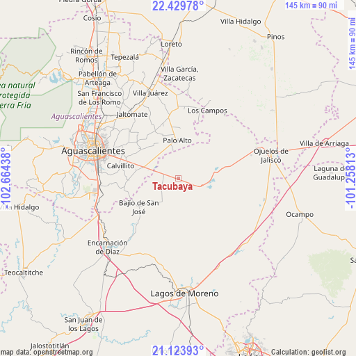
Tacubaya GPS coordinates[2]
21° 46' 42.024" North, 101° 57' 40.5" West
| Map corner | latitude | longitude |
|---|---|---|
| Upper-left | 22.42978°, | -102.66438° |
| Center: | 21.77834°, | -101.96125° |
| Lower-right: | 21.12393°, | -101.25813° |
| Map W x H: | 145.2×145.2 km | = 90.2×90.2mi |
| max Lat: | 32.7° ⇑17.2% North |
| Tacubaya: | 21.77834° |
| min Lat: | ⇓82.8% South 14.53588° |
| min Long | Tacubaya | max Long |
| -117.105° | -101.96125° | -86.73105° |
| W 19.3%⇐ | ⇒80.7% E |
Elevation
Elevation of Tacubaya is 2022 m = 6634 ft, and this is 768.3 m = 2521 ft above average elevation for this country.
| Max E: |
3497 m = 11473 ft | 25.5% |
| Tacubaya | 2022 m 6634 ft | |
| Avg. | 1253.7 m = 4113 ft | |
Min E: |
-1 m = -3 ft | 74.5% |
See also: Mexico elevation on elevation.city.
Geographical zone
Tacubaya is located in North Torrid zone (between Equator and Tropic of Cancer). Distance of this Northern Tropic circle is 184.4 km =114.6 mi to North.| Distance of | km | miles | from Tacubaya |
|---|---|---|---|
| North Pole | 7585.5 | 4713.4 | to North |
| Arctic Circle | 4979.6 | 3094.2 | to North |
| Tropic Cancer | 184.4 | 114.6 | to North |
| Equator | 2421.5 | 1504.6 | to South |


Nearby cities:
15 places around Tacubaya: (largest is in red/bold)
• Betulia
6.4 km =4 mi,  250°
250°
• Chinampas
16.4 km =10.2 mi,  66°
66°
• Cuautitlán
4.7 km =2.9 mi,  189°
189°
• El Tecuán
12.4 km =7.7 mi,  210°
210°
• Francisco Primo de Verdad (Ciénega de Mata)
14.4 km =8.9 mi,  104°
104°
• La Presa
15.1 km =9.4 mi,  91°
91°
• La Punta
4.3 km =2.7 mi,  29°
29°
• La Troje
7.9 km =4.9 mi,  131°
131°
• Las Güeras
16.7 km =10.4 mi, 246°
• Los Azulitos
7.5 km =4.7 mi,  356°
356°
• Los Conos
13.7 km =8.5 mi,  345°
345°
• Matamoros los Hoyos
9 km =5.6 mi,  314°
314°
• Montoya
11.3 km =7 mi, 349°
• Palo Alto
15.5 km =9.6 mi, 358°
• San Cristóbal
11 km =6.8 mi,  168°
168°
Sources, notices
• [Note1] Compared only with cities in Mexico existing in our database
• [Src1] Map data: © OpenStreetMap contributors (CC-BY-SA)
• [Src2] Other city data from geonames.org with taken over terms of usage.
• [Src3] Geographical zone / Annual Mean Temperature by Robert A. Rohde @ Wikipedia
