Las Negritas geodata
Las Negritas (Aguascalientes) is a populated place; located in Mexico in America/Mexico_City (GMT-6) time zone. With population of 713 people, there are 12219 cities with bigger population in this country. Compared to other cities in Mexico, 84.1% of cities are located further ↓South; 80.2% of cities are located further →East and 79.9% of cities have lower elevation than Las Negritas. Note1


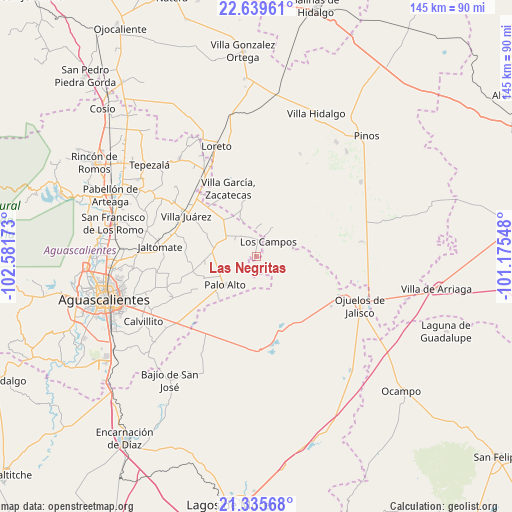
Las Negritas GPS coordinates[2]
21° 59' 20.904" North, 101° 52' 42.96" West
| Map corner | latitude | longitude |
|---|---|---|
| Upper-left | 22.63961°, | -102.58173° |
| Center: | 21.98914°, | -101.8786° |
| Lower-right: | 21.33568°, | -101.17548° |
| Map W x H: | 145×145 km | = 90.1×90.1mi |
| max Lat: | 32.7° ⇑15.9% North |
| Las Negritas: | 21.98914° |
| min Lat: | ⇓84.1% South 14.53588° |
| min Long | Las Negritas | max Long |
| -117.105° | -101.8786° | -86.73105° |
| W 19.8%⇐ | ⇒80.2% E |
Elevation
Elevation of Las Negritas is 2138 m = 7014 ft, and this is 884.3 m = 2901 ft above average elevation for this country.
| Max E: |
3497 m = 11473 ft | 20.1% |
| Las Negritas | 2138 m 7014 ft | |
| Avg. | 1253.7 m = 4113 ft | |
Min E: |
-1 m = -3 ft | 79.9% |
See also: Mexico elevation on elevation.city.
Geographical zone
Las Negritas is located in North Torrid zone (between Equator and Tropic of Cancer). Distance of this Northern Tropic circle is 161 km =100 mi to North.| Distance of | km | miles | from Las Negritas |
|---|---|---|---|
| North Pole | 7562.1 | 4698.9 | to North |
| Arctic Circle | 4956.2 | 3079.6 | to North |
| Tropic Cancer | 161 | 100 | to North |
| Equator | 2445 | 1519.3 | to South |


Nearby cities:
15 places around Las Negritas: (largest is in red/bold)
• Agua Gorda
13.8 km =8.6 mi,  341°
341°
• El Novillo
13.1 km =8.1 mi,  285°
285°
• Francisco Sarabia (La Reforma)
14.7 km =9.1 mi,  261°
261°
• Francisco Villa
14.4 km =8.9 mi,  319°
319°
• Granadas
12.5 km =7.8 mi,  7°
7°
• La Luz
12.2 km =7.6 mi,  275°
275°
• La Montesa
9.7 km =6 mi,  30°
30°
• Los Campos
5.5 km =3.4 mi,  40°
40°
• Los Conos
15.7 km =9.8 mi,  229°
229°
• Ojo de Agua de Crucitas
8.1 km =5 mi,  249°
249°
• Ojo de Agua de la Palma
15.7 km =9.8 mi,  84°
84°
• Palo Alto
11.9 km =7.4 mi, 228°
• Pilotos
9.9 km =6.2 mi,  302°
302°
• Santa Rosa (El Huizache)
16 km =9.9 mi, 247°
• Tierritas Blancas
15.1 km =9.4 mi, 344°
Sources, notices
• [Note1] Compared only with cities in Mexico existing in our database
• [Src1] Map data: © OpenStreetMap contributors (CC-BY-SA)
• [Src2] Other city data from geonames.org with taken over terms of usage.
• [Src3] Geographical zone / Annual Mean Temperature by Robert A. Rohde @ Wikipedia
