Los Azulitos geodata
Los Azulitos (Jalisco) is a populated place; located in Mexico in America/Mexico_City (GMT-6) time zone. With population of 2,217 people, there are 3960 cities with bigger population in this country. Compared to other cities in Mexico, 83.2% of cities are located further ↓South; 80.7% of cities are located further →East and 74.1% of cities have lower elevation than Los Azulitos. Note1


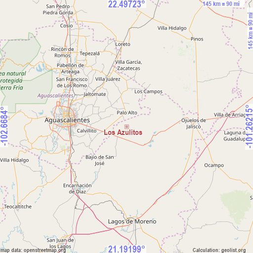
Los Azulitos GPS coordinates[2]
21° 50' 45.96" North, 101° 57' 54.972" West
| Map corner | latitude | longitude |
|---|---|---|
| Upper-left | 22.49723°, | -102.6684° |
| Center: | 21.8461°, | -101.96527° |
| Lower-right: | 21.19199°, | -101.26215° |
| Map W x H: | 145.1×145.1 km | = 90.2×90.2mi |
| max Lat: | 32.7° ⇑16.8% North |
| Los Azulitos: | 21.8461° |
| min Lat: | ⇓83.2% South 14.53588° |
| min Long | Los Azulitos | max Long |
| -117.105° | -101.96527° | -86.73105° |
| W 19.3%⇐ | ⇒80.7% E |
Elevation
Elevation of Los Azulitos is 2013 m = 6604 ft, and this is 759.3 m = 2491 ft above average elevation for this country.
| Max E: |
3497 m = 11473 ft | 25.9% |
| Los Azulitos | 2013 m 6604 ft | |
| Avg. | 1253.7 m = 4113 ft | |
Min E: |
-1 m = -3 ft | 74.1% |
See also: Mexico elevation on elevation.city.
Geographical zone
Los Azulitos is located in North Torrid zone (between Equator and Tropic of Cancer). Distance of this Northern Tropic circle is 176.9 km =109.9 mi to North.| Distance of | km | miles | from Los Azulitos |
|---|---|---|---|
| North Pole | 7578 | 4708.7 | to North |
| Arctic Circle | 4972.1 | 3089.5 | to North |
| Tropic Cancer | 176.9 | 109.9 | to North |
| Equator | 2429.1 | 1509.4 | to South |


Nearby cities:
15 places around Los Azulitos: (largest is in red/bold)
• Betulia
11.1 km =6.9 mi,  210°
210°
• Chinampas
15.5 km =9.6 mi,  93°
93°
• Cuautitlán
12.2 km =7.6 mi,  181°
181°
• Francisco Sarabia (La Reforma)
14.7 km =9.1 mi,  337°
337°
• La Luz
17.4 km =10.8 mi,  349°
349°
• La Presa
17.4 km =10.8 mi,  116°
116°
• La Punta
4.6 km =2.9 mi,  146°
146°
• La Troje
14.2 km =8.8 mi, 153°
• Los Conos
6.5 km =4 mi,  331°
331°
• Matamoros los Hoyos
6.1 km =3.8 mi,  258°
258°
• Montoya
4 km =2.5 mi, 335°
• Ojo de Agua de Crucitas
13.2 km =8.2 mi,  5°
5°
• Palo Alto
8 km =5 mi,  0°
0°
• Santa Rosa (El Huizache)
11.5 km =7.1 mi, 329°
• Tacubaya
7.5 km =4.7 mi, 176°
Sources, notices
• [Note1] Compared only with cities in Mexico existing in our database
• [Src1] Map data: © OpenStreetMap contributors (CC-BY-SA)
• [Src2] Other city data from geonames.org with taken over terms of usage.
• [Src3] Geographical zone / Annual Mean Temperature by Robert A. Rohde @ Wikipedia
