Caopas geodata
Caopas (Zacatecas) is a populated place; located in Mexico in America/Mexico_City (GMT-6) time zone. With population of 658 people, there are 13187 cities with bigger population in this country. Compared to other cities in Mexico, 91.4% of cities are located further ↓South; 81.9% of cities are located further →East and 73.2% of cities have lower elevation than Caopas. Note1


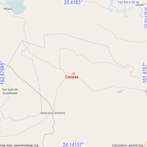
Caopas GPS coordinates[2]
24° 46' 53.688" North, 102° 10' 25.752" West
| Map corner | latitude | longitude |
|---|---|---|
| Upper-left | 25.4183°, | -102.87695° |
| Center: | 24.78158°, | -102.17382° |
| Lower-right: | 24.14157°, | -101.4707° |
| Map W x H: | 142×142 km | = 88.2×88.2mi |
| max Lat: | 32.7° ⇑8.6% North |
| Caopas: | 24.78158° |
| min Lat: | ⇓91.4% South 14.53588° |
| min Long | Caopas | max Long |
| -117.105° | -102.17382° | -86.73105° |
| W 18.1%⇐ | ⇒81.9% E |
Elevation
Elevation of Caopas is 1995 m = 6545 ft, and this is 741.3 m = 2432 ft above average elevation for this country.
| Max E: |
3497 m = 11473 ft | 26.8% |
| Caopas | 1995 m 6545 ft | |
| Avg. | 1253.7 m = 4113 ft | |
Min E: |
-1 m = -3 ft | 73.2% |
See also: Mexico elevation on elevation.city.
Geographical zone
Caopas is located in North temperate zone (between Tropic of Cancer and the Arctic Circle). Distance of this Northern Tropic circle is 149.5 km =92.9 mi to South.| Distance of | km | miles | from Caopas |
|---|---|---|---|
| North Pole | 7251.6 | 4505.9 | to North |
| Arctic Circle | 4645.7 | 2886.7 | to North |
| Tropic Cancer | 149.5 | 92.9 | to South |
| Equator | 2755.5 | 1712.2 | to South |


Nearby cities:
15 places around Caopas: (largest is in red/bold)
• Apizolaya
11 km =6.8 mi,  289°
289°
• Cedros
42 km =26.1 mi,  105°
105°
• Colonia Fovissste
83 km =51.6 mi,  103°
103°
• Concepción del Oro
78.6 km =48.8 mi, 103°
• Estación Camacho
42.9 km =26.7 mi,  207°
207°
• La Curva
81.5 km =50.6 mi, 102°
• Las Norias (Norias)
75.7 km =47 mi,  224°
224°
• Mazapil
64.5 km =40.1 mi, 104°
• Melchor Ocampo
53.9 km =33.5 mi,  84°
84°
• Parras de la Fuente
73.4 km =45.6 mi,  359°
359°
• San Francisco del Progreso
90.1 km =56 mi,  0°
0°
• San José de Morteros
91.6 km =56.9 mi,  238°
238°
• San Juan de Guadalupe
63.6 km =39.5 mi,  254°
254°
• Terminal de Providencia
72.2 km =44.9 mi, 97°
• Viesca
88.8 km =55.2 mi,  314°
314°
Sources, notices
• [Note1] Compared only with cities in Mexico existing in our database
• [Src1] Map data: © OpenStreetMap contributors (CC-BY-SA)
• [Src2] Other city data from geonames.org with taken over terms of usage.
• [Src3] Geographical zone / Annual Mean Temperature by Robert A. Rohde @ Wikipedia
