Apizolaya geodata
Apizolaya (Zacatecas) is a populated place; located in Mexico in America/Mexico_City (GMT-6) time zone. With population of 507 people, there are 16589 cities with bigger population in this country. Compared to other cities in Mexico, 91.5% of cities are located further ↓South; 82.6% of cities are located further →East and 65.4% of cities have lower elevation than Apizolaya. Note1


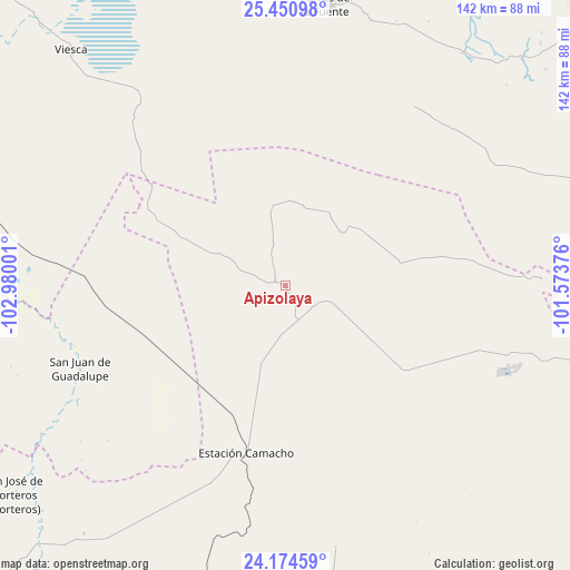
Apizolaya GPS coordinates[2]
24° 48' 51.948" North, 102° 16' 36.768" West
| Map corner | latitude | longitude |
|---|---|---|
| Upper-left | 25.45098°, | -102.98001° |
| Center: | 24.81443°, | -102.27688° |
| Lower-right: | 24.17459°, | -101.57376° |
| Map W x H: | 141.9×141.9 km | = 88.2×88.2mi |
| max Lat: | 32.7° ⇑8.5% North |
| Apizolaya: | 24.81443° |
| min Lat: | ⇓91.5% South 14.53588° |
| min Long | Apizolaya | max Long |
| -117.105° | -102.27688° | -86.73105° |
| W 17.4%⇐ | ⇒82.6% E |
Elevation
Elevation of Apizolaya is 1839 m = 6033 ft, and this is 585.3 m = 1920 ft above average elevation for this country.
| Max E: |
3497 m = 11473 ft | 34.6% |
| Apizolaya | 1839 m 6033 ft | |
| Avg. | 1253.7 m = 4113 ft | |
Min E: |
-1 m = -3 ft | 65.4% |
See also: Mexico elevation on elevation.city.
Geographical zone
Apizolaya is located in North temperate zone (between Tropic of Cancer and the Arctic Circle). Distance of this Northern Tropic circle is 153.2 km =95.2 mi to South.| Distance of | km | miles | from Apizolaya |
|---|---|---|---|
| North Pole | 7248 | 4503.7 | to North |
| Arctic Circle | 4642.1 | 2884.5 | to North |
| Tropic Cancer | 153.2 | 95.2 | to South |
| Equator | 2759.1 | 1714.4 | to South |


Nearby cities:
15 places around Apizolaya: (largest is in red/bold)
• Caopas
11 km =6.8 mi,  109°
109°
• Cedros
53 km =32.9 mi, 106°
• Concepción del Oro
89.5 km =55.6 mi,  104°
104°
• Ejido Venustiano Carranza
90.8 km =56.4 mi,  311°
311°
• Estación Camacho
42.7 km =26.5 mi,  193°
193°
• La Curva
92.5 km =57.5 mi, 103°
• Las Norias (Norias)
71.6 km =44.5 mi,  216°
216°
• Mazapil
75.5 km =46.9 mi, 104°
• Melchor Ocampo
64 km =39.8 mi,  88°
88°
• Parras de la Fuente
70.5 km =43.8 mi,  8°
8°
• San Francisco del Progreso
87.1 km =54.1 mi, 7°
• San José de Morteros
85.1 km =52.9 mi,  232°
232°
• San Juan de Guadalupe
54.9 km =34.1 mi,  248°
248°
• Terminal de Providencia
83 km =51.6 mi, 99°
• Viesca
78.9 km =49 mi,  317°
317°
Sources, notices
• [Note1] Compared only with cities in Mexico existing in our database
• [Src1] Map data: © OpenStreetMap contributors (CC-BY-SA)
• [Src2] Other city data from geonames.org with taken over terms of usage.
• [Src3] Geographical zone / Annual Mean Temperature by Robert A. Rohde @ Wikipedia
