Rancho Nuevo geodata
Rancho Nuevo (Jalisco) is a populated place; located in Mexico in America/Mexico_City (GMT-6) time zone. With population of 501 people, there are 16785 cities with bigger population in this country. Compared to other cities in Mexico, 58.6% of cities are located further ↑North; 84.8% of cities are located further →East and 67.9% of cities have higher elevation than Rancho Nuevo. Note1


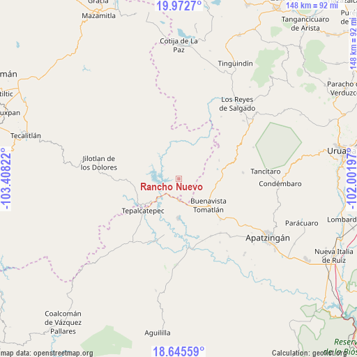
Rancho Nuevo GPS coordinates[2]
19° 18' 37.764" North, 102° 42' 18.324" West
| Map corner | latitude | longitude |
|---|---|---|
| Upper-left | 19.9727°, | -103.40822° |
| Center: | 19.31049°, | -102.70509° |
| Lower-right: | 18.64559°, | -102.00197° |
| Map W x H: | 147.6×147.6 km | = 91.7×91.7mi |
| max Lat: | 32.7° ⇑58.6% North |
| Rancho Nuevo: | 19.31049° |
| min Lat: | ⇓41.4% South 14.53588° |
| min Long | Rancho Nuevo | max Long |
| -117.105° | -102.70509° | -86.73105° |
| W 15.2%⇐ | ⇒84.8% E |
Elevation
Elevation of Rancho Nuevo is 535 m = 1755 ft, and this is 718.7 m = 2358 ft below average elevation for this country.
| Max E: |
3497 m = 11473 ft | 67.9% |
| Avg. | 1253.7 m = 4113 ft | |
| Rancho Nuevo | 535 m = 1755 ft | |
Min E: |
-1 m = -3 ft | 32.1% |
See also: Mexico elevation on elevation.city.
Geographical zone
Rancho Nuevo is located in North Torrid zone (between Equator and Tropic of Cancer). Distance of this Northern Tropic circle is 458.8 km =285.1 mi to North.| Distance of | km | miles | from Rancho Nuevo |
|---|---|---|---|
| North Pole | 7859.9 | 4883.9 | to North |
| Arctic Circle | 5254 | 3264.7 | to North |
| Tropic Cancer | 458.8 | 285.1 | to North |
| Equator | 2147.1 | 1334.1 | to South |


Nearby cities:
15 places around Rancho Nuevo: (largest is in red/bold)
• Buenavista Tomatlán
16.5 km =10.3 mi,  131°
131°
• Buenavistilla (La Garita)
26 km =16.2 mi,  161°
161°
• Dieciocho de Marzo
8.8 km =5.5 mi,  180°
180°
• División del Norte
27.2 km =16.9 mi, 158°
• El Terrero
29.3 km =18.2 mi,  168°
168°
• Felipe Carrillo Puerto
16.4 km =10.2 mi, 181°
• Loma Blanca
27.5 km =17.1 mi,  200°
200°
• Los Olivos
20 km =12.4 mi,  235°
235°
• Pinzándaro
28.2 km =17.5 mi,  142°
142°
• Punta del Agua
24.3 km =15.1 mi, 170°
• Páreo
26.6 km =16.5 mi,  84°
84°
• Santa Ana Amatlán
24 km =14.9 mi, 133°
• Tazumbo
6.6 km =4.1 mi,  106°
106°
• Tepalcatepec
20.5 km =12.7 mi,  227°
227°
• Villa Doctor Gómez (Las Lomas)
14.1 km =8.8 mi,  19°
19°
Sources, notices
• [Note1] Compared only with cities in Mexico existing in our database
• [Src1] Map data: © OpenStreetMap contributors (CC-BY-SA)
• [Src2] Other city data from geonames.org with taken over terms of usage.
• [Src3] Geographical zone / Annual Mean Temperature by Robert A. Rohde @ Wikipedia
