Bajosori geodata
Bajosori (Sinaloa) is a populated place; located in Mexico in America/Mazatlan (GMT-7) time zone. With population of 734 people, there are 11902 cities with bigger population in this country. Compared to other cities in Mexico, 95.9% of cities are located further ↓South; 96.1% of cities are located further →East and 71.6% of cities have higher elevation than Bajosori. Note1


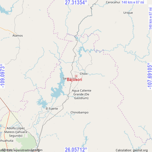
Bajosori GPS coordinates[2]
26° 41' 13.416" North, 108° 23' 39.012" West
| Map corner | latitude | longitude |
|---|---|---|
| Upper-left | 27.31354°, | -109.0973° |
| Center: | 26.68706°, | -108.39417° |
| Lower-right: | 26.05712°, | -107.69105° |
| Map W x H: | 139.7×139.7 km | = 86.8×86.8mi |
| max Lat: | 32.7° ⇑4.1% North |
| Bajosori: | 26.68706° |
| min Lat: | ⇓95.9% South 14.53588° |
| min Long | Bajosori | max Long |
| -117.105° | -108.39417° | -86.73105° |
| W 3.9%⇐ | ⇒96.1% E |
Elevation
Elevation of Bajosori is 343 m = 1125 ft, and this is 910.7 m = 2988 ft below average elevation for this country.
| Max E: |
3497 m = 11473 ft | 71.6% |
| Avg. | 1253.7 m = 4113 ft | |
| Bajosori | 343 m = 1125 ft | |
Min E: |
-1 m = -3 ft | 28.4% |
See also: Mexico elevation on elevation.city.
Geographical zone
Bajosori is located in North temperate zone (between Tropic of Cancer and the Arctic Circle). Distance of this Northern Tropic circle is 361.4 km =224.6 mi to South.| Distance of | km | miles | from Bajosori |
|---|---|---|---|
| North Pole | 7039.7 | 4374.3 | to North |
| Arctic Circle | 4433.9 | 2755.1 | to North |
| Tropic Cancer | 361.4 | 224.6 | to South |
| Equator | 2967.3 | 1843.8 | to South |


Nearby cities:
15 places around Bajosori: (largest is in red/bold)
• Agua Caliente Grande (De Gastélum)
17.2 km =10.7 mi,  164°
164°
• Baroten
41 km =25.5 mi,  219°
219°
• Boca de Arroyo
54.5 km =33.9 mi, 221°
• Chinobampo
33.2 km =20.6 mi,  174°
174°
• Choix
7.2 km =4.5 mi,  70°
70°
• El Canutillo
41.7 km =25.9 mi,  213°
213°
• El Fuerte
37.4 km =23.2 mi, 216°
• Estación Hoyancos (Estación el Fuerte)
40.7 km =25.3 mi, 209°
• Guadalupe
10.4 km =6.5 mi,  134°
134°
• La Bajada del Monte
49.4 km =30.7 mi, 218°
• Los Capomos
31.7 km =19.7 mi,  202°
202°
• San Javier
6.6 km =4.1 mi,  256°
256°
• San Pedro
19.9 km =12.4 mi, 203°
• Santa Ana
10.9 km =6.8 mi,  175°
175°
• Tehueco
55.8 km =34.7 mi, 218°
Sources, notices
• [Note1] Compared only with cities in Mexico existing in our database
• [Src1] Map data: © OpenStreetMap contributors (CC-BY-SA)
• [Src2] Other city data from geonames.org with taken over terms of usage.
• [Src3] Geographical zone / Annual Mean Temperature by Robert A. Rohde @ Wikipedia
