Bacabachi geodata
Bacabachi (Sonora) is a populated place; located in Mexico in America/Hermosillo (GMT-7) time zone. With population of 1,380 people, there are 6280 cities with bigger population in this country. Compared to other cities in Mexico, 96.1% of cities are located further ↓South; 97.4% of cities are located further →East and 83.5% of cities have higher elevation than Bacabachi. Note1


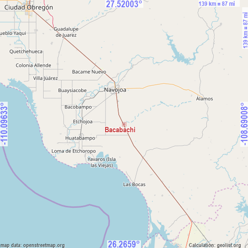
Bacabachi GPS coordinates[2]
26° 53' 40.956" North, 109° 23' 35.52" West
| Map corner | latitude | longitude |
|---|---|---|
| Upper-left | 27.52003°, | -110.09633° |
| Center: | 26.89471°, | -109.3932° |
| Lower-right: | 26.2659°, | -108.69008° |
| Map W x H: | 139.4×139.4 km | = 86.6×86.6mi |
| max Lat: | 32.7° ⇑3.9% North |
| Bacabachi: | 26.89471° |
| min Lat: | ⇓96.1% South 14.53588° |
| min Long | Bacabachi | max Long |
| -117.105° | -109.3932° | -86.73105° |
| W 2.6%⇐ | ⇒97.4% E |
Elevation
Elevation of Bacabachi is 56 m = 184 ft, and this is 1197.7 m = 3929 ft below average elevation for this country.
| Max E: |
3497 m = 11473 ft | 83.5% |
| Avg. | 1253.7 m = 4113 ft | |
| Bacabachi | 56 m = 184 ft | |
Min E: |
-1 m = -3 ft | 16.5% |
See also: Mexico elevation on elevation.city.
Geographical zone
Bacabachi is located in North temperate zone (between Tropic of Cancer and the Arctic Circle). Distance of this Northern Tropic circle is 384.5 km =238.9 mi to South.| Distance of | km | miles | from Bacabachi |
|---|---|---|---|
| North Pole | 7016.7 | 4360 | to North |
| Arctic Circle | 4410.8 | 2740.7 | to North |
| Tropic Cancer | 384.5 | 238.9 | to South |
| Equator | 2990.4 | 1858.1 | to South |


Nearby cities:
15 places around Bacabachi: (largest is in red/bold)
• Buayums
5.4 km =3.4 mi,  229°
229°
• Chinotahueca
19.9 km =12.4 mi,  316°
316°
• Chirajobampo
1.1 km =0.7 mi,  284°
284°
• Chucarit
24.3 km =15.1 mi,  308°
308°
• El Saneal
1.9 km =1.2 mi,  14°
14°
• Etchojoa
23.2 km =14.4 mi,  274°
274°
• Jopopaco
21.1 km =13.1 mi,  145°
145°
• La Unión
22.9 km =14.2 mi,  248°
248°
• Las Playitas
24 km =14.9 mi,  294°
294°
• Masiaca
21.4 km =13.3 mi,  132°
132°
• Navojoa
20.2 km =12.6 mi,  345°
345°
• Navolato
23.3 km =14.5 mi, 311°
• San José Masiaca
22 km =13.7 mi,  138°
138°
• Sebampo
17.8 km =11.1 mi,  264°
264°
• Sinahuiza
4.9 km =3 mi, 291°
Sources, notices
• [Note1] Compared only with cities in Mexico existing in our database
• [Src1] Map data: © OpenStreetMap contributors (CC-BY-SA)
• [Src2] Other city data from geonames.org with taken over terms of usage.
• [Src3] Geographical zone / Annual Mean Temperature by Robert A. Rohde @ Wikipedia
