Ayutla geodata
Ayutla (Jalisco) is a seat of a second-order administrative division; located in Mexico in America/Mexico_City (GMT-6) time zone. With population of 7,244 people, there are 1282 cities with bigger population in this country. Compared to other cities in Mexico, 59.8% of cities are located further ↓South; 90.7% of cities are located further →East and 51.3% of cities have higher elevation than Ayutla. Note1


Ayutla GPS coordinates[2]
20° 7' 44.652" North, 104° 20' 36.78" West
| Map corner | latitude | longitude |
|---|---|---|
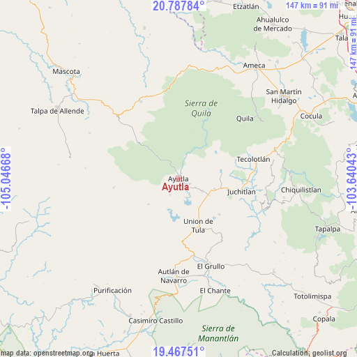
| Upper-left | 20.78784°, | -105.04668° |
| Center: | 20.12907°, | -104.34355° |
| Lower-right: | 19.46751°, | -103.64043° |
| Map W x H: | 146.8×146.8 km | = 91.2×91.2mi |
| max Lat: | 32.7° ⇑40.2% North |
| Ayutla: | 20.12907° |
| min Lat: | ⇓59.8% South 14.53588° |
| min Long | Ayutla | max Long |
| -117.105° | -104.34355° | -86.73105° |
| W 9.3%⇐ | ⇒90.7% E |
Elevation
Elevation of Ayutla is 1370 m = 4495 ft, and this is 116.3 m = 382 ft above average elevation for this country.
| Max E: |
3497 m = 11473 ft | 51.3% |
| Ayutla | 1370 m 4495 ft | |
| Avg. | 1253.7 m = 4113 ft | |
Min E: |
-1 m = -3 ft | 48.7% |
See also: Mexico elevation on elevation.city.
Geographical zone
Ayutla is located in North Torrid zone (between Equator and Tropic of Cancer). Distance of this Northern Tropic circle is 367.8 km =228.5 mi to North.| Distance of | km | miles | from Ayutla |
|---|---|---|---|
| North Pole | 7768.9 | 4827.4 | to North |
| Arctic Circle | 5163 | 3208.1 | to North |
| Tropic Cancer | 367.8 | 228.5 | to North |
| Equator | 2238.1 | 1390.7 | to South |


Nearby cities:
15 places around Ayutla: (largest is in red/bold)
• Atengo
19.6 km =12.2 mi,  34°
34°
• Colotitlán
20.2 km =12.6 mi,  100°
100°
• Cuautla
10.5 km =6.5 mi,  320°
320°
• Ejutla
31.3 km =19.4 mi,  142°
142°
• El Salto
28 km =17.4 mi, 324°
• Juanacatlán
11.6 km =7.2 mi,  53°
53°
• Juchitlán
26 km =16.2 mi, 100°
• La Tijera
26.1 km =16.2 mi,  193°
193°
• Los Volcanes
29.8 km =18.5 mi, 316°
• San Clemente
10.8 km =6.7 mi,  117°
117°
• Soyatlán del Oro
20.3 km =12.6 mi,  18°
18°
• Tecolotlán
31.9 km =19.8 mi,  75°
75°
• Tenamaxtlán
21.1 km =13.1 mi,  62°
62°
• Tepantla
6.6 km =4.1 mi,  11°
11°
• Unión de Tula
20.7 km =12.9 mi,  157°
157°
Sources, notices
• [Note1] Compared only with cities in Mexico existing in our database
• [Src1] Map data: © OpenStreetMap contributors (CC-BY-SA)
• [Src2] Other city data from geonames.org with taken over terms of usage.
• [Src3] Geographical zone / Annual Mean Temperature by Robert A. Rohde @ Wikipedia
