Cuautla geodata
Cuautla (Jalisco) is a populated place; located in Mexico in America/Mexico_City (GMT-6) time zone. With population of 1,253 people, there are 6913 cities with bigger population in this country. Compared to other cities in Mexico, 61.4% of cities are located further ↓South; 90.8% of cities are located further →East and 59.6% of cities have lower elevation than Cuautla. Note1


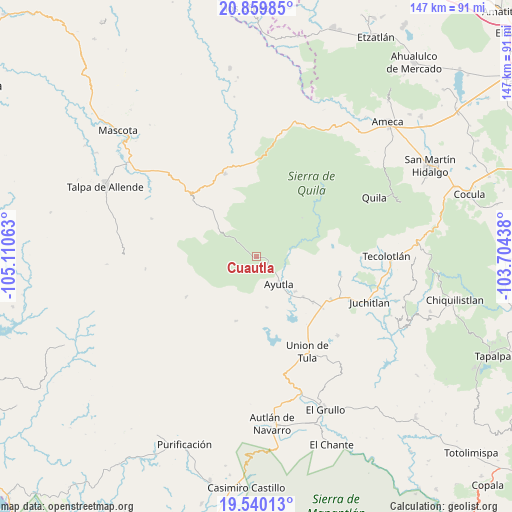
Cuautla GPS coordinates[2]
20° 12' 5.004" North, 104° 24' 27" West
| Map corner | latitude | longitude |
|---|---|---|
| Upper-left | 20.85985°, | -105.11063° |
| Center: | 20.20139°, | -104.4075° |
| Lower-right: | 19.54013°, | -103.70438° |
| Map W x H: | 146.7×146.7 km | = 91.2×91.2mi |
| max Lat: | 32.7° ⇑38.6% North |
| Cuautla: | 20.20139° |
| min Lat: | ⇓61.4% South 14.53588° |
| min Long | Cuautla | max Long |
| -117.105° | -104.4075° | -86.73105° |
| W 9.2%⇐ | ⇒90.8% E |
Elevation
Elevation of Cuautla is 1719 m = 5640 ft, and this is 465.3 m = 1527 ft above average elevation for this country.
| Max E: |
3497 m = 11473 ft | 40.4% |
| Cuautla | 1719 m 5640 ft | |
| Avg. | 1253.7 m = 4113 ft | |
Min E: |
-1 m = -3 ft | 59.6% |
See also: Mexico elevation on elevation.city.
Geographical zone
Cuautla is located in North Torrid zone (between Equator and Tropic of Cancer). Distance of this Northern Tropic circle is 359.7 km =223.5 mi to North.| Distance of | km | miles | from Cuautla |
|---|---|---|---|
| North Pole | 7760.9 | 4822.4 | to North |
| Arctic Circle | 5155 | 3203.2 | to North |
| Tropic Cancer | 359.7 | 223.5 | to North |
| Equator | 2246.2 | 1395.7 | to South |


Nearby cities:
15 places around Cuautla: (largest is in red/bold)
• Atengo
19.5 km =12.1 mi,  65°
65°
• Atenguillo
25.5 km =15.8 mi,  339°
339°
• Ayutla
10.5 km =6.5 mi,  140°
140°
• Colotitlán
29 km =18 mi,  113°
113°
• El Salto
17.6 km =10.9 mi,  326°
326°
• Juanacatlán
16 km =9.9 mi,  94°
94°
• Juchitlán
34.7 km =21.6 mi, 111°
• La Tijera
33.5 km =20.8 mi,  178°
178°
• Los Volcanes
19.4 km =12.1 mi,  314°
314°
• Mixtlán
26.4 km =16.4 mi,  359°
359°
• San Clemente
20.8 km =12.9 mi,  128°
128°
• Soyatlán del Oro
17.3 km =10.7 mi,  49°
49°
• Tenamaxtlán
25.4 km =15.8 mi, 85°
• Tepantla
8.2 km =5.1 mi,  100°
100°
• Unión de Tula
30.9 km =19.2 mi,  151°
151°
Sources, notices
• [Note1] Compared only with cities in Mexico existing in our database
• [Src1] Map data: © OpenStreetMap contributors (CC-BY-SA)
• [Src2] Other city data from geonames.org with taken over terms of usage.
• [Src3] Geographical zone / Annual Mean Temperature by Robert A. Rohde @ Wikipedia
