Agua Caliente geodata
Agua Caliente (Michoacán) is a populated place; located in Mexico in America/Mexico_City (GMT-6) time zone. With population of 1,042 people, there are 8364 cities with bigger population in this country. Compared to other cities in Mexico, 58.4% of cities are located further ↓South; 79.3% of cities are located further →East and 60.4% of cities have lower elevation than Agua Caliente. Note1


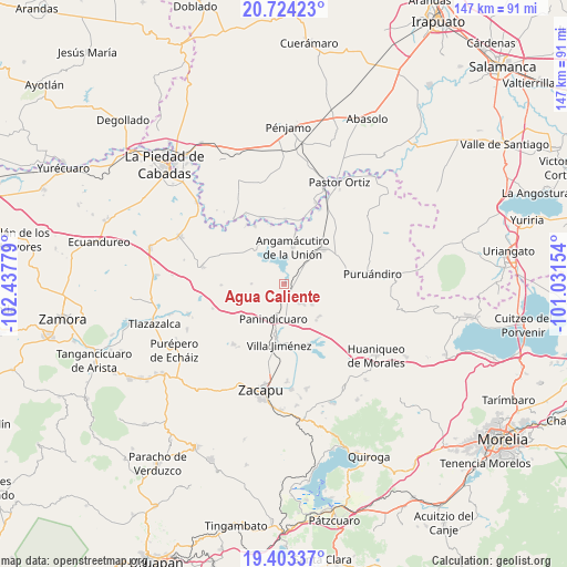
Agua Caliente GPS coordinates[2]
20° 3' 54.684" North, 101° 44' 4.776" West
| Map corner | latitude | longitude |
|---|---|---|
| Upper-left | 20.72423°, | -102.43779° |
| Center: | 20.06519°, | -101.73466° |
| Lower-right: | 19.40337°, | -101.03154° |
| Map W x H: | 146.9×146.9 km | = 91.3×91.3mi |
| max Lat: | 32.7° ⇑41.6% North |
| Agua Caliente: | 20.06519° |
| min Lat: | ⇓58.4% South 14.53588° |
| min Long | Agua Caliente | max Long |
| -117.105° | -101.73466° | -86.73105° |
| W 20.7%⇐ | ⇒79.3% E |
Elevation
Elevation of Agua Caliente is 1731 m = 5679 ft, and this is 477.3 m = 1566 ft above average elevation for this country.
| Max E: |
3497 m = 11473 ft | 39.6% |
| Agua Caliente | 1731 m 5679 ft | |
| Avg. | 1253.7 m = 4113 ft | |
Min E: |
-1 m = -3 ft | 60.4% |
See also: Mexico elevation on elevation.city.
Geographical zone
Agua Caliente is located in North Torrid zone (between Equator and Tropic of Cancer). Distance of this Northern Tropic circle is 374.9 km =233 mi to North.| Distance of | km | miles | from Agua Caliente |
|---|---|---|---|
| North Pole | 7776 | 4831.8 | to North |
| Arctic Circle | 5170.1 | 3212.6 | to North |
| Tropic Cancer | 374.9 | 233 | to North |
| Equator | 2231 | 1386.3 | to South |


Nearby cities:
15 places around Agua Caliente: (largest is in red/bold)
• Angamacutiro de la Unión
9.7 km =6 mi,  14°
14°
• Curimeo
6.5 km =4 mi,  140°
140°
• El Fresno de la Reforma
12.3 km =7.6 mi,  194°
194°
• El Maluco
10.8 km =6.7 mi,  35°
35°
• J. Trinidad Regalado (La Colonia)
4.3 km =2.7 mi,  200°
200°
• La Estancia del Río
2.7 km =1.7 mi,  78°
78°
• La Palma
3.1 km =1.9 mi,  348°
348°
• Miravalle
9.4 km =5.8 mi,  24°
24°
• Nuevo Progreso (Casas Viejas)
8.9 km =5.5 mi,  101°
101°
• Panindícuaro
9.3 km =5.8 mi, 197°
• San José del Maluco
10.3 km =6.4 mi,  29°
29°
• San Lorenzo
12.6 km =7.8 mi,  132°
132°
• San Miguel
9.8 km =6.1 mi,  106°
106°
• San Miguel Epejan
8.5 km =5.3 mi,  270°
270°
• Urequío
10.9 km =6.8 mi,  153°
153°
Sources, notices
• [Note1] Compared only with cities in Mexico existing in our database
• [Src1] Map data: © OpenStreetMap contributors (CC-BY-SA)
• [Src2] Other city data from geonames.org with taken over terms of usage.
• [Src3] Geographical zone / Annual Mean Temperature by Robert A. Rohde @ Wikipedia
