Abraham González geodata
Abraham González (Chihuahua) is a populated place; located in Mexico in America/Chihuahua (GMT-6) time zone. With population of 560 people, there are 15231 cities with bigger population in this country. Compared to other cities in Mexico, 98% of cities are located further ↓South; 94.9% of cities are located further →East and 68.2% of cities have lower elevation than Abraham González. Note1


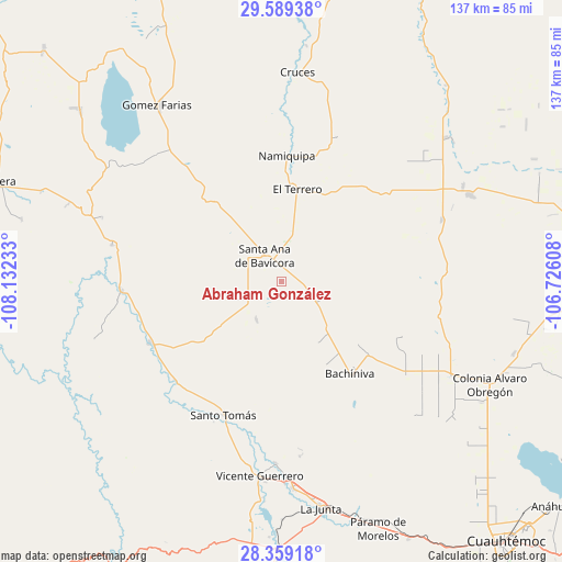
Abraham González GPS coordinates[2]
28° 58' 33.996" North, 107° 25' 45.12" West
| Map corner | latitude | longitude |
|---|---|---|
| Upper-left | 29.58938°, | -108.13233° |
| Center: | 28.97611°, | -107.4292° |
| Lower-right: | 28.35918°, | -106.72608° |
| Map W x H: | 136.8×136.8 km | = 85×85mi |
| max Lat: | 32.7° ⇑2% North |
| Abraham González: | 28.97611° |
| min Lat: | ⇓98% South 14.53588° |
| min Long | Abraham Gonzál | max Long |
| -117.105° | -107.4292° | -86.73105° |
| W 5.1%⇐ | ⇒94.9% E |
Elevation
Elevation of Abraham González is 1893 m = 6211 ft, and this is 639.3 m = 2097 ft above average elevation for this country.
| Max E: |
3497 m = 11473 ft | 31.8% |
| Abraham González | 1893 m 6211 ft | |
| Avg. | 1253.7 m = 4113 ft | |
Min E: |
-1 m = -3 ft | 68.2% |
See also: Mexico elevation on elevation.city.
Geographical zone
Abraham González is located in North temperate zone (between Tropic of Cancer and the Arctic Circle). Distance of this Northern Tropic circle is 615.9 km =382.7 mi to South.| Distance of | km | miles | from Abraham González |
|---|---|---|---|
| North Pole | 6785.2 | 4216.1 | to North |
| Arctic Circle | 4179.3 | 2596.9 | to North |
| Tropic Cancer | 615.9 | 382.7 | to South |
| Equator | 3221.8 | 2001.9 | to South |


Nearby cities:
15 places around Abraham González: (largest is in red/bold)
• Bachíniva
28.7 km =17.8 mi,  143°
143°
• Ejido La Quemada
42.2 km =26.2 mi,  109°
109°
• El Molino
24.1 km =15 mi,  5°
5°
• El Terrero
23.2 km =14.4 mi, 10°
• Guerrero
47.8 km =29.7 mi,  186°
186°
• Independencia
17 km =10.6 mi,  319°
319°
• La Pinta
37 km =23 mi, 320°
• Lázaro Cárdenas
42 km =26.1 mi,  69°
69°
• Matachí
35 km =21.7 mi,  244°
244°
• Namiquipa
30.7 km =19.1 mi,  2°
2°
• Oscar Soto Maynez
7.3 km =4.5 mi, 324°
• Peña Blanca
44.4 km =27.6 mi, 321°
• San José Bavícora
43.4 km =27 mi,  314°
314°
• Santo Tomás
35.6 km =22.1 mi,  203°
203°
• Temósachic
39 km =24.2 mi,  266°
266°
Sources, notices
• [Note1] Compared only with cities in Mexico existing in our database
• [Src1] Map data: © OpenStreetMap contributors (CC-BY-SA)
• [Src2] Other city data from geonames.org with taken over terms of usage.
• [Src3] Geographical zone / Annual Mean Temperature by Robert A. Rohde @ Wikipedia
