Santo Tomás geodata
Santo Tomás (Chihuahua) is a populated place; located in Mexico in America/Chihuahua (GMT-6) time zone. With population of 674 people, there are 12893 cities with bigger population in this country. Compared to other cities in Mexico, 97.9% of cities are located further ↓South; 95.1% of cities are located further →East and 72.2% of cities have lower elevation than Santo Tomás. Note1


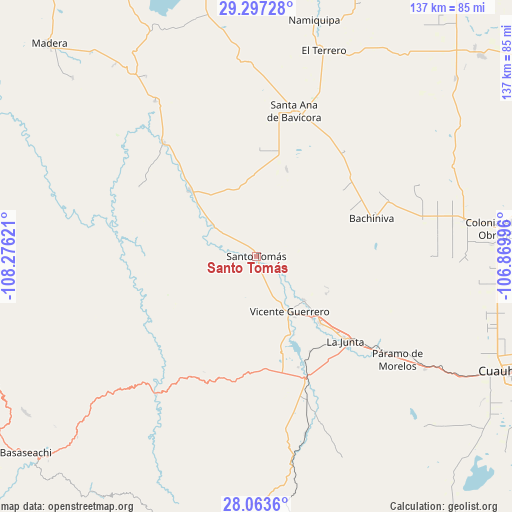
Santo Tomás GPS coordinates[2]
28° 40' 56.136" North, 107° 34' 23.088" West
| Map corner | latitude | longitude |
|---|---|---|
| Upper-left | 29.29728°, | -108.27621° |
| Center: | 28.68226°, | -107.57308° |
| Lower-right: | 28.0636°, | -106.86996° |
| Map W x H: | 137.2×137.2 km | = 85.3×85.3mi |
| max Lat: | 32.7° ⇑2.1% North |
| Santo Tomás: | 28.68226° |
| min Lat: | ⇓97.9% South 14.53588° |
| min Long | Santo Tomás | max Long |
| -117.105° | -107.57308° | -86.73105° |
| W 4.9%⇐ | ⇒95.1% E |
Elevation
Elevation of Santo Tomás is 1970 m = 6463 ft, and this is 716.3 m = 2350 ft above average elevation for this country.
| Max E: |
3497 m = 11473 ft | 27.8% |
| Santo Tomás | 1970 m 6463 ft | |
| Avg. | 1253.7 m = 4113 ft | |
Min E: |
-1 m = -3 ft | 72.2% |
See also: Mexico elevation on elevation.city.
Geographical zone
Santo Tomás is located in North temperate zone (between Tropic of Cancer and the Arctic Circle). Distance of this Northern Tropic circle is 583.2 km =362.4 mi to South.| Distance of | km | miles | from Santo Tomás |
|---|---|---|---|
| North Pole | 6817.9 | 4236.4 | to North |
| Arctic Circle | 4212 | 2617.2 | to North |
| Tropic Cancer | 583.2 | 362.4 | to South |
| Equator | 3189.2 | 1981.7 | to South |


Nearby cities:
15 places around Santo Tomás: (largest is in red/bold)
• Abraham González
35.6 km =22.1 mi,  23°
23°
• Adolfo López Mateos
35.9 km =22.3 mi,  131°
131°
• Bachíniva
32.4 km =20.1 mi,  72°
72°
• Basúchil
24.2 km =15 mi,  136°
136°
• Borjas
22.4 km =13.9 mi, 138°
• Guerrero
17.2 km =10.7 mi,  149°
149°
• Independencia
45.7 km =28.4 mi,  3°
3°
• La Junta
32.7 km =20.3 mi, 133°
• Matachí
25.2 km =15.7 mi,  315°
315°
• Oscar Soto Maynez
39.8 km =24.7 mi,  14°
14°
• Paramo
46.9 km =29.1 mi, 126°
• Sáenz
29.7 km =18.5 mi, 133°
• Tacuba
38.1 km =23.7 mi,  165°
165°
• Temósachic
39.3 km =24.4 mi, 320°
• Tomochic
45.3 km =28.1 mi,  216°
216°
Sources, notices
• [Note1] Compared only with cities in Mexico existing in our database
• [Src1] Map data: © OpenStreetMap contributors (CC-BY-SA)
• [Src2] Other city data from geonames.org with taken over terms of usage.
• [Src3] Geographical zone / Annual Mean Temperature by Robert A. Rohde @ Wikipedia
