Independencia geodata
Independencia (Chihuahua) is a populated place; located in Mexico in America/Chihuahua (GMT-6) time zone. With population of 1,088 people, there are 8000 cities with bigger population in this country. Compared to other cities in Mexico, 98.1% of cities are located further ↓South; 95% of cities are located further →East and 71.3% of cities have lower elevation than Independencia. Note1


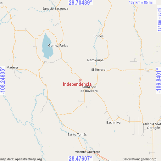
Independencia GPS coordinates[2]
29° 5' 32.316" North, 107° 32' 35.592" West
| Map corner | latitude | longitude |
|---|---|---|
| Upper-left | 29.70489°, | -108.24635° |
| Center: | 29.09231°, | -107.54322° |
| Lower-right: | 28.47607°, | -106.8401° |
| Map W x H: | 136.6×136.6 km | = 84.9×84.9mi |
| max Lat: | 32.7° ⇑1.9% North |
| Independencia: | 29.09231° |
| min Lat: | ⇓98.1% South 14.53588° |
| min Long | Independencia | max Long |
| -117.105° | -107.54322° | -86.73105° |
| W 5%⇐ | ⇒95% E |
Elevation
Elevation of Independencia is 1951 m = 6401 ft, and this is 697.3 m = 2288 ft above average elevation for this country.
| Max E: |
3497 m = 11473 ft | 28.7% |
| Independencia | 1951 m 6401 ft | |
| Avg. | 1253.7 m = 4113 ft | |
Min E: |
-1 m = -3 ft | 71.3% |
See also: Mexico elevation on elevation.city.
Geographical zone
Independencia is located in North temperate zone (between Tropic of Cancer and the Arctic Circle). Distance of this Northern Tropic circle is 628.8 km =390.7 mi to South.| Distance of | km | miles | from Independencia |
|---|---|---|---|
| North Pole | 6772.3 | 4208.1 | to North |
| Arctic Circle | 4166.4 | 2588.9 | to North |
| Tropic Cancer | 628.8 | 390.7 | to South |
| Equator | 3234.8 | 2010 | to South |


Nearby cities:
15 places around Independencia: (largest is in red/bold)
• Abraham González
17 km =10.6 mi,  139°
139°
• Bachíniva
45.6 km =28.3 mi, 142°
• El Molino
17.3 km =10.7 mi,  50°
50°
• El Terrero
18.1 km =11.2 mi,  56°
56°
• Gómez Farías
35.3 km =21.9 mi,  327°
327°
• La Pinta
20 km =12.4 mi,  321°
321°
• Las Cruces
40.7 km =25.3 mi,  21°
21°
• Matachí
34.6 km =21.5 mi,  216°
216°
• Namiquipa
21.7 km =13.5 mi,  35°
35°
• Nicolas Bravo
47.8 km =29.7 mi,  307°
307°
• Oscar Soto Maynez
9.8 km =6.1 mi, 135°
• Peña Blanca
27.4 km =17 mi, 323°
• San José Bavícora
26.5 km =16.5 mi, 311°
• Santo Tomás
45.7 km =28.4 mi,  183°
183°
• Temósachic
31.8 km =19.8 mi,  241°
241°
Sources, notices
• [Note1] Compared only with cities in Mexico existing in our database
• [Src1] Map data: © OpenStreetMap contributors (CC-BY-SA)
• [Src2] Other city data from geonames.org with taken over terms of usage.
• [Src3] Geographical zone / Annual Mean Temperature by Robert A. Rohde @ Wikipedia
