Francisco Sarabia (La Reforma) geodata
Francisco Sarabia (La Reforma) (Aguascalientes) is a populated place; located in Mexico in America/Mexico_City (GMT-6) time zone. With population of 625 people, there are 13838 cities with bigger population in this country. Compared to other cities in Mexico, 84% of cities are located further ↓South; 81.1% of cities are located further →East and 74.8% of cities have lower elevation than Francisco Sarabia (La Reforma). Note1
Current local time in Francisco Sarabia (La Reforma):
08:33 AM, WednesdayDifference from your time zone: hours


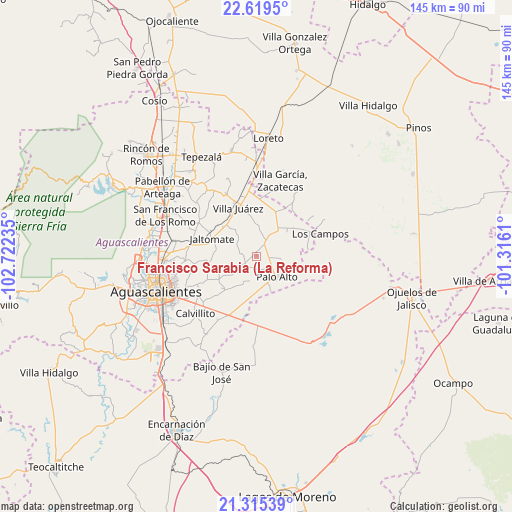
Francisco Sarabia (La Reforma) GPS coordinates[2]
21° 58' 8.184" North, 102° 1' 9.192" West
| Map corner | latitude | longitude |
|---|---|---|
| Upper-left | 22.6195°, | -102.72235° |
| Center: | 21.96894°, | -102.01922° |
| Lower-right: | 21.31539°, | -101.3161° |
| Map W x H: | 145×145 km | = 90.1×90.1mi |
| max Lat: | 32.7° ⇑16% North |
| Francisco Sarabia (La Reforma): | 21.96894° |
| min Lat: | ⇓84% South 14.53588° |
| min Long | Francisco Sarab | max Long |
| -117.105° | -102.01922° | -86.73105° |
| W 18.9%⇐ | ⇒81.1% E |
Elevation
Elevation of Francisco Sarabia (La Reforma) is 2027 m = 6650 ft, and this is 773.3 m = 2537 ft above average elevation for this country.
| Max E: |
3497 m = 11473 ft | 25.2% |
| Francisco Sarabia (La Reforma) | 2027 m 6650 ft | |
| Avg. | 1253.7 m = 4113 ft | |
Min E: |
-1 m = -3 ft | 74.8% |
See also: Mexico elevation on elevation.city.
Geographical zone
Francisco Sarabia (La Reforma) is located in North Torrid zone (between Equator and Tropic of Cancer). Distance of this Northern Tropic circle is 163.2 km =101.4 mi to North.| Distance of | km | miles | from Francisco Sarabia (La Reforma) |
|---|---|---|---|
| North Pole | 7564.3 | 4700.2 | to North |
| Arctic Circle | 4958.5 | 3081.1 | to North |
| Tropic Cancer | 163.2 | 101.4 | to North |
| Equator | 2442.7 | 1517.8 | to South |


Nearby cities:
15 places around Francisco Sarabia (La Reforma): (largest is in red/bold)
• El Novillo
6 km =3.7 mi,  18°
18°
• Francisco Villa
14.2 km =8.8 mi, 21°
• Jaltomate
14 km =8.7 mi,  291°
291°
• Jilotepec
9.7 km =6 mi,  321°
321°
• La Dichosa
12.4 km =7.7 mi,  310°
310°
• La Luz
4.2 km =2.6 mi,  34°
34°
• Las Negritas
14.7 km =9.1 mi,  81°
81°
• Licenciado Jesús Terán (El Muerto)
4.7 km =2.9 mi,  282°
282°
• Los Conos
8.3 km =5.2 mi,  162°
162°
• Montoya
10.8 km =6.7 mi, 158°
• Ojo de Agua de Crucitas
6.9 km =4.3 mi,  94°
94°
• Palo Alto
8 km =5 mi,  135°
135°
• Pilotos
9.8 km =6.1 mi,  39°
39°
• Santa María Gallardo
13.3 km =8.3 mi, 311°
• Santa Rosa (El Huizache)
3.8 km =2.4 mi,  184°
184°
Sources, notices
• [Note1] Compared only with cities in Mexico existing in our database
• [Src1] Map data: © OpenStreetMap contributors (CC-BY-SA)
• [Src2] Other city data from geonames.org with taken over terms of usage.
• [Src3] Geographical zone / Annual Mean Temperature by Robert A. Rohde @ Wikipedia
