Los Conos geodata
Los Conos (Aguascalientes) is a populated place; located in Mexico in America/Mexico_City (GMT-6) time zone. With population of 1,108 people, there are 7843 cities with bigger population in this country. Compared to other cities in Mexico, 83.5% of cities are located further ↓South; 80.9% of cities are located further →East and 73.6% of cities have lower elevation than Los Conos. Note1


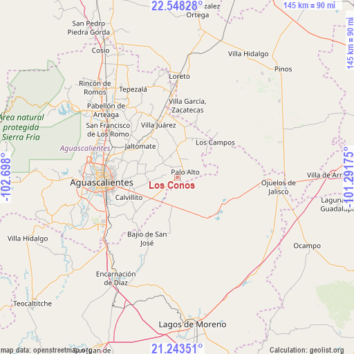
Los Conos GPS coordinates[2]
21° 53' 50.604" North, 101° 59' 41.532" West
| Map corner | latitude | longitude |
|---|---|---|
| Upper-left | 22.54828°, | -102.698° |
| Center: | 21.89739°, | -101.99487° |
| Lower-right: | 21.24351°, | -101.29175° |
| Map W x H: | 145.1×145.1 km | = 90.2×90.2mi |
| max Lat: | 32.7° ⇑16.5% North |
| Los Conos: | 21.89739° |
| min Lat: | ⇓83.5% South 14.53588° |
| min Long | Los Conos | max Long |
| -117.105° | -101.99487° | -86.73105° |
| W 19.1%⇐ | ⇒80.9% E |
Elevation
Elevation of Los Conos is 2003 m = 6572 ft, and this is 749.3 m = 2458 ft above average elevation for this country.
| Max E: |
3497 m = 11473 ft | 26.4% |
| Los Conos | 2003 m 6572 ft | |
| Avg. | 1253.7 m = 4113 ft | |
Min E: |
-1 m = -3 ft | 73.6% |
See also: Mexico elevation on elevation.city.
Geographical zone
Los Conos is located in North Torrid zone (between Equator and Tropic of Cancer). Distance of this Northern Tropic circle is 171.2 km =106.4 mi to North.| Distance of | km | miles | from Los Conos |
|---|---|---|---|
| North Pole | 7572.3 | 4705.2 | to North |
| Arctic Circle | 4966.4 | 3086 | to North |
| Tropic Cancer | 171.2 | 106.4 | to North |
| Equator | 2434.8 | 1512.9 | to South |


Nearby cities:
15 places around Los Conos: (largest is in red/bold)
• Betulia
15.6 km =9.7 mi,  189°
189°
• El Novillo
13.6 km =8.5 mi,  357°
357°
• Francisco Sarabia (La Reforma)
8.3 km =5.2 mi,  342°
342°
• La Luz
11.4 km =7.1 mi, 359°
• La Punta
11 km =6.8 mi,  149°
149°
• Las Negritas
15.7 km =9.8 mi,  49°
49°
• Licenciado Jesús Terán (El Muerto)
11.5 km =7.1 mi,  321°
321°
• Los Azulitos
6.5 km =4 mi, 151°
• Matamoros los Hoyos
7.5 km =4.7 mi,  202°
202°
• Montoya
2.5 km =1.6 mi, 145°
• Ojo de Agua de Crucitas
8.6 km =5.3 mi,  30°
30°
• Palo Alto
3.9 km =2.4 mi, 53°
• Pilotos
16 km =9.9 mi,  13°
13°
• Santa Rosa (El Huizache)
5 km =3.1 mi,  326°
326°
• Tacubaya
13.7 km =8.5 mi,  165°
165°
Sources, notices
• [Note1] Compared only with cities in Mexico existing in our database
• [Src1] Map data: © OpenStreetMap contributors (CC-BY-SA)
• [Src2] Other city data from geonames.org with taken over terms of usage.
• [Src3] Geographical zone / Annual Mean Temperature by Robert A. Rohde @ Wikipedia
