La Noria geodata
La Noria (Guanajuato) is a populated place; located in Mexico in America/Mexico_City (GMT-6) time zone. With population of 843 people, there are 10377 cities with bigger population in this country. Compared to other cities in Mexico, 78.2% of cities are located further ↓South; 68.2% of cities are located further →East and 76.6% of cities have lower elevation than La Noria. Note1


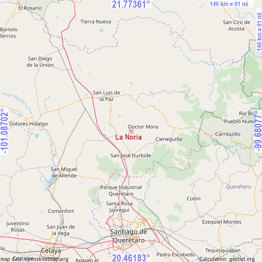
La Noria GPS coordinates[2]
21° 7' 9.012" North, 100° 23' 2.004" West
| Map corner | latitude | longitude |
|---|---|---|
| Upper-left | 21.77361°, | -101.08702° |
| Center: | 21.11917°, | -100.38389° |
| Lower-right: | 20.46183°, | -99.68077° |
| Map W x H: | 145.9×145.9 km | = 90.7×90.7mi |
| max Lat: | 32.7° ⇑21.8% North |
| La Noria: | 21.11917° |
| min Lat: | ⇓78.2% South 14.53588° |
| min Long | La Noria | max Long |
| -117.105° | -100.38389° | -86.73105° |
| W 31.8%⇐ | ⇒68.2% E |
Elevation
Elevation of La Noria is 2060 m = 6759 ft, and this is 806.3 m = 2645 ft above average elevation for this country.
| Max E: |
3497 m = 11473 ft | 23.4% |
| La Noria | 2060 m 6759 ft | |
| Avg. | 1253.7 m = 4113 ft | |
Min E: |
-1 m = -3 ft | 76.6% |
See also: Mexico elevation on elevation.city.
Geographical zone
La Noria is located in North Torrid zone (between Equator and Tropic of Cancer). Distance of this Northern Tropic circle is 257.7 km =160.1 mi to North.| Distance of | km | miles | from La Noria |
|---|---|---|---|
| North Pole | 7658.8 | 4759 | to North |
| Arctic Circle | 5052.9 | 3139.7 | to North |
| Tropic Cancer | 257.7 | 160.1 | to North |
| Equator | 2348.2 | 1459.1 | to South |


Nearby cities:
15 places around La Noria: (largest is in red/bold)
• Derramadero de Charcas
7.9 km =4.9 mi,  98°
98°
• Doctor Mora
7.1 km =4.4 mi,  68°
68°
• Galomo
8.4 km =5.2 mi,  219°
219°
• La Laguna
7.9 km =4.9 mi,  269°
269°
• La Redonda
8 km =5 mi,  120°
120°
• La Reforma
7.4 km =4.6 mi,  185°
185°
• La Yerbabuena
10.1 km =6.3 mi,  161°
161°
• Las Adjuntas
7.2 km =4.5 mi,  205°
205°
• Loma de Buenavista
7.7 km =4.8 mi,  30°
30°
• Miranda
7 km =4.3 mi,  130°
130°
• Morisquilla
4.8 km =3 mi, 129°
• Pueblo Nuevo
3.3 km =2.1 mi,  227°
227°
• San Rafael
3.4 km =2.1 mi,  63°
63°
• San Sebastián de Salitre
10.2 km =6.3 mi,  259°
259°
• Vagui
6.5 km =4 mi,  42°
42°
Sources, notices
• [Note1] Compared only with cities in Mexico existing in our database
• [Src1] Map data: © OpenStreetMap contributors (CC-BY-SA)
• [Src2] Other city data from geonames.org with taken over terms of usage.
• [Src3] Geographical zone / Annual Mean Temperature by Robert A. Rohde @ Wikipedia
