Labor de Peralta geodata
Labor de Peralta (Guanajuato) is a populated place; located in Mexico in America/Mexico_City (GMT-6) time zone. With population of 1,418 people, there are 6095 cities with bigger population in this country. Compared to other cities in Mexico, 65.8% of cities are located further ↓South; 76.6% of cities are located further →East and 58.8% of cities have lower elevation than Labor de Peralta. Note1


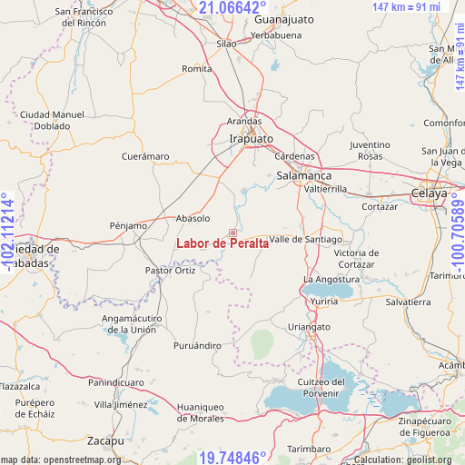
Labor de Peralta GPS coordinates[2]
20° 24' 31.86" North, 101° 24' 32.436" West
| Map corner | latitude | longitude |
|---|---|---|
| Upper-left | 21.06642°, | -102.11214° |
| Center: | 20.40885°, | -101.40901° |
| Lower-right: | 19.74846°, | -100.70589° |
| Map W x H: | 146.5×146.5 km | = 91×91mi |
| max Lat: | 32.7° ⇑34.2% North |
| Labor de Peralta: | 20.40885° |
| min Lat: | ⇓65.8% South 14.53588° |
| min Long | Labor de Peralt | max Long |
| -117.105° | -101.40901° | -86.73105° |
| W 23.4%⇐ | ⇒76.6% E |
Elevation
Elevation of Labor de Peralta is 1704 m = 5591 ft, and this is 450.3 m = 1477 ft above average elevation for this country.
| Max E: |
3497 m = 11473 ft | 41.2% |
| Labor de Peralta | 1704 m 5591 ft | |
| Avg. | 1253.7 m = 4113 ft | |
Min E: |
-1 m = -3 ft | 58.8% |
See also: Mexico elevation on elevation.city.
Geographical zone
Labor de Peralta is located in North Torrid zone (between Equator and Tropic of Cancer). Distance of this Northern Tropic circle is 336.7 km =209.2 mi to North.| Distance of | km | miles | from Labor de Peralta |
|---|---|---|---|
| North Pole | 7737.8 | 4808 | to North |
| Arctic Circle | 5131.9 | 3188.8 | to North |
| Tropic Cancer | 336.7 | 209.2 | to North |
| Equator | 2269.3 | 1410.1 | to South |


Nearby cities:
15 places around Labor de Peralta: (largest is in red/bold)
• Boquillas
2.7 km =1.7 mi,  288°
288°
• Cerro Colorado
8.8 km =5.5 mi,  95°
95°
• Charco de Pantoja
6.1 km =3.8 mi,  110°
110°
• Guarapo
2.9 km =1.8 mi,  184°
184°
• La Tinaja de Negrete
7.7 km =4.8 mi,  311°
311°
• Las Raíces
6.4 km =4 mi,  202°
202°
• Otates
7.6 km =4.7 mi,  263°
263°
• Peralta
7.2 km =4.5 mi,  0°
0°
• Piedras Negras
3 km =1.9 mi,  36°
36°
• Rincón de Alonso Sánchez
7.8 km =4.8 mi,  15°
15°
• San Bernardo Peña Blanca
9.7 km =6 mi, 307°
• San Cristóbal
2.3 km =1.4 mi,  148°
148°
• San José de Ayala
4.2 km =2.6 mi,  234°
234°
• Santa Bárbara
9.7 km =6 mi, 39°
• Zapote de Peralta
4.9 km =3 mi, 17°
Sources, notices
• [Note1] Compared only with cities in Mexico existing in our database
• [Src1] Map data: © OpenStreetMap contributors (CC-BY-SA)
• [Src2] Other city data from geonames.org with taken over terms of usage.
• [Src3] Geographical zone / Annual Mean Temperature by Robert A. Rohde @ Wikipedia
