Tungüitiro geodata
Tungüitiro (State of Mexico) is a populated place; located in Mexico in America/Mexico_City (GMT-6) time zone. With population of 611 people, there are 14112 cities with bigger population in this country. Compared to other cities in Mexico, 52.4% of cities are located further ↓South; 78.3% of cities are located further →East and 76.1% of cities have lower elevation than Tungüitiro. Note1


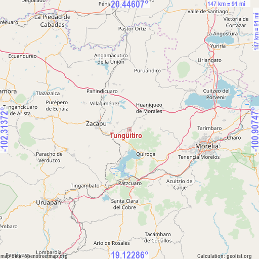
Tungüitiro GPS coordinates[2]
19° 47' 9.024" North, 101° 36' 38.124" West
| Map corner | latitude | longitude |
|---|---|---|
| Upper-left | 20.44607°, | -102.31372° |
| Center: | 19.78584°, | -101.61059° |
| Lower-right: | 19.12286°, | -100.90747° |
| Map W x H: | 147.1×147.1 km | = 91.4×91.4mi |
| max Lat: | 32.7° ⇑47.6% North |
| Tungüitiro: | 19.78584° |
| min Lat: | ⇓52.4% South 14.53588° |
| min Long | Tungüitiro | max Long |
| -117.105° | -101.61059° | -86.73105° |
| W 21.7%⇐ | ⇒78.3% E |
Elevation
Elevation of Tungüitiro is 2050 m = 6726 ft, and this is 796.3 m = 2613 ft above average elevation for this country.
| Max E: |
3497 m = 11473 ft | 23.9% |
| Tungüitiro | 2050 m 6726 ft | |
| Avg. | 1253.7 m = 4113 ft | |
Min E: |
-1 m = -3 ft | 76.1% |
See also: Mexico elevation on elevation.city.
Geographical zone
Tungüitiro is located in North Torrid zone (between Equator and Tropic of Cancer). Distance of this Northern Tropic circle is 405.9 km =252.2 mi to North.| Distance of | km | miles | from Tungüitiro |
|---|---|---|---|
| North Pole | 7807.1 | 4851.1 | to North |
| Arctic Circle | 5201.2 | 3231.9 | to North |
| Tropic Cancer | 405.9 | 252.2 | to North |
| Equator | 2200 | 1367 | to South |


Nearby cities:
15 places around Tungüitiro: (largest is in red/bold)
• Bellas Fuentes
8.2 km =5.1 mi,  298°
298°
• Cantabria
13.5 km =8.4 mi, 296°
• Coeneo de la Libertad
4.8 km =3 mi,  34°
34°
• Comanjá
9.4 km =5.8 mi,  242°
242°
• Cortijo Nuevo
9.5 km =5.9 mi,  268°
268°
• Cortijo Viejo
8.8 km =5.5 mi,  279°
279°
• David Franco Reyes
12.4 km =7.7 mi,  254°
254°
• La Cañada
10.3 km =6.4 mi,  52°
52°
• Matugeo
5.9 km =3.7 mi,  185°
185°
• San Andrés Ziróndaro
13.1 km =8.1 mi, 189°
• San Isidro
8.4 km =5.2 mi, 31°
• San Jerónimo Purenchecuaro
11.9 km =7.4 mi,  180°
180°
• Santiago Azajo
11.9 km =7.4 mi,  222°
222°
• Tarejero
11.6 km =7.2 mi,  288°
288°
• Zipiajo
6.2 km =3.9 mi,  81°
81°
Sources, notices
• [Note1] Compared only with cities in Mexico existing in our database
• [Src1] Map data: © OpenStreetMap contributors (CC-BY-SA)
• [Src2] Other city data from geonames.org with taken over terms of usage.
• [Src3] Geographical zone / Annual Mean Temperature by Robert A. Rohde @ Wikipedia
