Matugeo geodata
Matugeo (Michoacán) is a populated place; located in Mexico in America/Mexico_City (GMT-6) time zone. With population of 508 people, there are 16554 cities with bigger population in this country. Compared to other cities in Mexico, 51.2% of cities are located further ↓South; 78.3% of cities are located further →East and 77.5% of cities have lower elevation than Matugeo. Note1


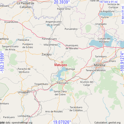
Matugeo GPS coordinates[2]
19° 44' 0.42" North, 101° 36' 57.096" West
| Map corner | latitude | longitude |
|---|---|---|
| Upper-left | 20.3939°, | -102.31899° |
| Center: | 19.73345°, | -101.61586° |
| Lower-right: | 19.07026°, | -100.91274° |
| Map W x H: | 147.2×147.2 km | = 91.5×91.5mi |
| max Lat: | 32.7° ⇑48.8% North |
| Matugeo: | 19.73345° |
| min Lat: | ⇓51.2% South 14.53588° |
| min Long | Matugeo | max Long |
| -117.105° | -101.61586° | -86.73105° |
| W 21.7%⇐ | ⇒78.3% E |
Elevation
Elevation of Matugeo is 2079 m = 6821 ft, and this is 825.3 m = 2708 ft above average elevation for this country.
| Max E: |
3497 m = 11473 ft | 22.5% |
| Matugeo | 2079 m 6821 ft | |
| Avg. | 1253.7 m = 4113 ft | |
Min E: |
-1 m = -3 ft | 77.5% |
See also: Mexico elevation on elevation.city.
Geographical zone
Matugeo is located in North Torrid zone (between Equator and Tropic of Cancer). Distance of this Northern Tropic circle is 411.8 km =255.9 mi to North.| Distance of | km | miles | from Matugeo |
|---|---|---|---|
| North Pole | 7812.9 | 4854.7 | to North |
| Arctic Circle | 5207 | 3235.5 | to North |
| Tropic Cancer | 411.8 | 255.9 | to North |
| Equator | 2194.2 | 1363.4 | to South |


Nearby cities:
15 places around Matugeo: (largest is in red/bold)
• Bellas Fuentes
11.8 km =7.3 mi,  325°
325°
• Coeneo de la Libertad
10.4 km =6.5 mi,  18°
18°
• Comanjá
8 km =5 mi,  280°
280°
• Cortijo Nuevo
10.5 km =6.5 mi,  301°
301°
• Cortijo Viejo
10.9 km =6.8 mi,  311°
311°
• David Franco Reyes
11.7 km =7.3 mi, 282°
• Quiroga
12.3 km =7.6 mi,  127°
127°
• San Andrés Ziróndaro
7.3 km =4.5 mi,  193°
193°
• San Isidro
13.8 km =8.6 mi, 21°
• San Jerónimo Purenchecuaro
6 km =3.7 mi,  176°
176°
• Santa Fé de la Laguna
9.3 km =5.8 mi,  136°
136°
• Santiago Azajo
8 km =5 mi,  248°
248°
• Tungüitiro
5.9 km =3.7 mi,  5°
5°
• Tzintzuntzán
12.3 km =7.6 mi,  161°
161°
• Zipiajo
9.5 km =5.9 mi,  44°
44°
Sources, notices
• [Note1] Compared only with cities in Mexico existing in our database
• [Src1] Map data: © OpenStreetMap contributors (CC-BY-SA)
• [Src2] Other city data from geonames.org with taken over terms of usage.
• [Src3] Geographical zone / Annual Mean Temperature by Robert A. Rohde @ Wikipedia
