La Cañada geodata
La Cañada (State of Mexico) is a populated place; located in Mexico in America/Mexico_City (GMT-6) time zone. With population of 895 people, there are 9743 cities with bigger population in this country. Compared to other cities in Mexico, 53.8% of cities are located further ↓South; 77.7% of cities are located further →East and 75.9% of cities have lower elevation than La Cañada. Note1


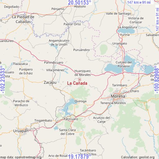
La Cañada GPS coordinates[2]
19° 50' 29.544" North, 101° 31' 55.92" West
| Map corner | latitude | longitude |
|---|---|---|
| Upper-left | 20.50153°, | -102.23533° |
| Center: | 19.84154°, | -101.5322° |
| Lower-right: | 19.17879°, | -100.82908° |
| Map W x H: | 147.1×147.1 km | = 91.4×91.4mi |
| max Lat: | 32.7° ⇑46.2% North |
| La Cañada: | 19.84154° |
| min Lat: | ⇓53.8% South 14.53588° |
| min Long | La Cañada | max Long |
| -117.105° | -101.5322° | -86.73105° |
| W 22.3%⇐ | ⇒77.7% E |
Elevation
Elevation of La Cañada is 2047 m = 6716 ft, and this is 793.3 m = 2603 ft above average elevation for this country.
| Max E: |
3497 m = 11473 ft | 24.1% |
| La Cañada | 2047 m 6716 ft | |
| Avg. | 1253.7 m = 4113 ft | |
Min E: |
-1 m = -3 ft | 75.9% |
See also: Mexico elevation on elevation.city.
Geographical zone
La Cañada is located in North Torrid zone (between Equator and Tropic of Cancer). Distance of this Northern Tropic circle is 399.7 km =248.4 mi to North.| Distance of | km | miles | from La Cañada |
|---|---|---|---|
| North Pole | 7800.9 | 4847.3 | to North |
| Arctic Circle | 5195 | 3228 | to North |
| Tropic Cancer | 399.7 | 248.4 | to North |
| Equator | 2206.2 | 1370.9 | to South |


Nearby cities:
15 places around La Cañada: (largest is in red/bold)
• Aracurio
10.2 km =6.3 mi,  138°
138°
• Bellas Fuentes
15.6 km =9.7 mi,  261°
261°
• Coeneo de la Libertad
5.9 km =3.7 mi,  248°
248°
• Copándaro (Copándaro del Cuatro)
14.8 km =9.2 mi,  296°
296°
• Cortijo Nuevo
18.8 km =11.7 mi, 249°
• Cortijo Viejo
17.5 km =10.9 mi, 254°
• Huaniqueo de Morales
6.8 km =4.2 mi,  25°
25°
• Matugeo
14.9 km =9.3 mi,  216°
216°
• San Isidro
3.9 km =2.4 mi,  283°
283°
• Santa Fé de la Laguna
18.9 km =11.7 mi,  187°
187°
• Tecacho
6.2 km =3.9 mi,  85°
85°
• Tendeparacua
12.1 km =7.5 mi,  59°
59°
• Teremendo
8.3 km =5.2 mi, 138°
• Tungüitiro
10.3 km =6.4 mi,  232°
232°
• Zipiajo
5.7 km =3.5 mi,  202°
202°
Sources, notices
• [Note1] Compared only with cities in Mexico existing in our database
• [Src1] Map data: © OpenStreetMap contributors (CC-BY-SA)
• [Src2] Other city data from geonames.org with taken over terms of usage.
• [Src3] Geographical zone / Annual Mean Temperature by Robert A. Rohde @ Wikipedia
