Villa Eréndira geodata
Villa Eréndira (Michoacán) is a populated place; located in Mexico in America/Mexico_City (GMT-6) time zone. With population of 698 people, there are 12480 cities with bigger population in this country. Compared to other cities in Mexico, 61.7% of cities are located further ↑North; 80.2% of cities are located further →East and 67.3% of cities have higher elevation than Villa Eréndira. Note1


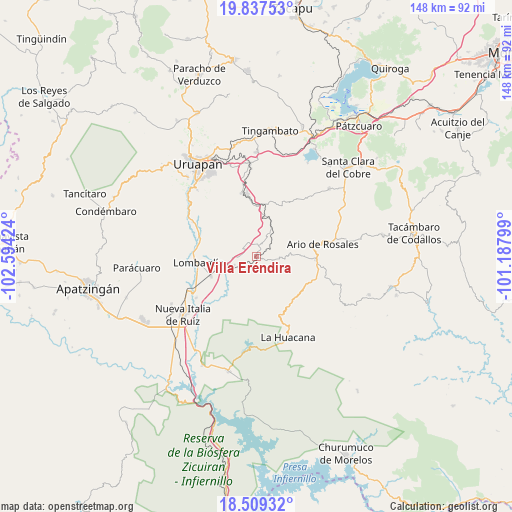
Villa Eréndira GPS coordinates[2]
19° 10' 29.136" North, 101° 53' 27.996" West
| Map corner | latitude | longitude |
|---|---|---|
| Upper-left | 19.83753°, | -102.59424° |
| Center: | 19.17476°, | -101.89111° |
| Lower-right: | 18.50932°, | -101.18799° |
| Map W x H: | 147.7×147.7 km | = 91.8×91.8mi |
| max Lat: | 32.7° ⇑61.7% North |
| Villa Eréndira: | 19.17476° |
| min Lat: | ⇓38.3% South 14.53588° |
| min Long | Villa Eréndira | max Long |
| -117.105° | -101.89111° | -86.73105° |
| W 19.8%⇐ | ⇒80.2% E |
Elevation
Elevation of Villa Eréndira is 568 m = 1864 ft, and this is 685.7 m = 2250 ft below average elevation for this country.
| Max E: |
3497 m = 11473 ft | 67.3% |
| Avg. | 1253.7 m = 4113 ft | |
| Villa Eréndira | 568 m = 1864 ft | |
Min E: |
-1 m = -3 ft | 32.7% |
See also: Mexico elevation on elevation.city.
Geographical zone
Villa Eréndira is located in North Torrid zone (between Equator and Tropic of Cancer). Distance of this Northern Tropic circle is 473.9 km =294.5 mi to North.| Distance of | km | miles | from Villa Eréndira |
|---|---|---|---|
| North Pole | 7875 | 4893.3 | to North |
| Arctic Circle | 5269.1 | 3274.1 | to North |
| Tropic Cancer | 473.9 | 294.5 | to North |
| Equator | 2132 | 1324.8 | to South |


Nearby cities:
15 places around Villa Eréndira: (largest is in red/bold)
• Doctor Miguel Silva Macías
17.3 km =10.7 mi,  93°
93°
• El Sabino
15.6 km =9.7 mi,  327°
327°
• La Florida
16 km =9.9 mi,  9°
9°
• La Ibérica (La Gotera)
2.9 km =1.8 mi,  246°
246°
• La Purísima
14.8 km =9.2 mi,  359°
359°
• Lombardía
16.9 km =10.5 mi,  263°
263°
• Los Cajones
4.5 km =2.8 mi, 329°
• Los Otates
6.8 km =4.2 mi, 94°
• Los Tumines
17.6 km =10.9 mi,  96°
96°
• Nuevo Urecho
2.6 km =1.6 mi,  111°
111°
• San José de Chuén
17.7 km =11 mi,  51°
51°
• San Vicente
12.2 km =7.6 mi,  22°
22°
• Santa Casilda
7 km =4.3 mi, 249°
• Tahuejo
17.6 km =10.9 mi,  335°
335°
• Tomendán
15.5 km =9.6 mi, 12°
Sources, notices
• [Note1] Compared only with cities in Mexico existing in our database
• [Src1] Map data: © OpenStreetMap contributors (CC-BY-SA)
• [Src2] Other city data from geonames.org with taken over terms of usage.
• [Src3] Geographical zone / Annual Mean Temperature by Robert A. Rohde @ Wikipedia
