Los Tumines geodata
Los Tumines (Michoacán) is a populated place; located in Mexico in America/Mexico_City (GMT-6) time zone. With population of 660 people, there are 13154 cities with bigger population in this country. Compared to other cities in Mexico, 62.1% of cities are located further ↑North; 79.2% of cities are located further →East and 52.6% of cities have lower elevation than Los Tumines. Note1


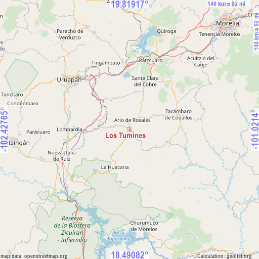
Los Tumines GPS coordinates[2]
19° 9' 22.788" North, 101° 43' 28.272" West
| Map corner | latitude | longitude |
|---|---|---|
| Upper-left | 19.81917°, | -102.42765° |
| Center: | 19.15633°, | -101.72452° |
| Lower-right: | 18.49082°, | -101.0214° |
| Map W x H: | 147.7×147.7 km | = 91.8×91.8mi |
| max Lat: | 32.7° ⇑62.1% North |
| Los Tumines: | 19.15633° |
| min Lat: | ⇓37.9% South 14.53588° |
| min Long | Los Tumines | max Long |
| -117.105° | -101.72452° | -86.73105° |
| W 20.8%⇐ | ⇒79.2% E |
Elevation
Elevation of Los Tumines is 1535 m = 5036 ft, and this is 281.3 m = 923 ft above average elevation for this country.
| Max E: |
3497 m = 11473 ft | 47.4% |
| Los Tumines | 1535 m 5036 ft | |
| Avg. | 1253.7 m = 4113 ft | |
Min E: |
-1 m = -3 ft | 52.6% |
See also: Mexico elevation on elevation.city.
Geographical zone
Los Tumines is located in North Torrid zone (between Equator and Tropic of Cancer). Distance of this Northern Tropic circle is 475.9 km =295.7 mi to North.| Distance of | km | miles | from Los Tumines |
|---|---|---|---|
| North Pole | 7877.1 | 4894.6 | to North |
| Arctic Circle | 5271.2 | 3275.4 | to North |
| Tropic Cancer | 475.9 | 295.7 | to North |
| Equator | 2130 | 1323.5 | to South |


Nearby cities:
15 places around Los Tumines: (largest is in red/bold)
• Ario de Rosales
6.1 km =3.8 mi,  17°
17°
• Doctor Miguel Silva Macías
1 km =0.6 mi,  344°
344°
• El Cahulote de Santa Ana
17.4 km =10.8 mi,  120°
120°
• El Chupadero
10.4 km =6.5 mi,  70°
70°
• El Tepamal
14.8 km =9.2 mi,  50°
50°
• Las Puentes
14.9 km =9.3 mi,  149°
149°
• Los Hacheros
16.4 km =10.2 mi,  95°
95°
• Los Otates
10.8 km =6.7 mi,  278°
278°
• Nuevo Urecho
15.1 km =9.4 mi,  274°
274°
• Pablo Cuin
9.8 km =6.1 mi,  42°
42°
• Pinal Grande
16.8 km =10.4 mi,  111°
111°
• San José de Chuén
13.7 km =8.5 mi, 344°
• Urapa
7.6 km =4.7 mi,  139°
139°
• Villa Eréndira
17.6 km =10.9 mi, 276°
• Zatzio (Tzatzio)
14.6 km =9.1 mi,  60°
60°
Sources, notices
• [Note1] Compared only with cities in Mexico existing in our database
• [Src1] Map data: © OpenStreetMap contributors (CC-BY-SA)
• [Src2] Other city data from geonames.org with taken over terms of usage.
• [Src3] Geographical zone / Annual Mean Temperature by Robert A. Rohde @ Wikipedia
