Santa Casilda geodata
Santa Casilda (Michoacán) is a populated place; located in Mexico in America/Mexico_City (GMT-6) time zone. With population of 1,318 people, there are 6582 cities with bigger population in this country. Compared to other cities in Mexico, 62.1% of cities are located further ↑North; 80.7% of cities are located further →East and 69.3% of cities have higher elevation than Santa Casilda. Note1


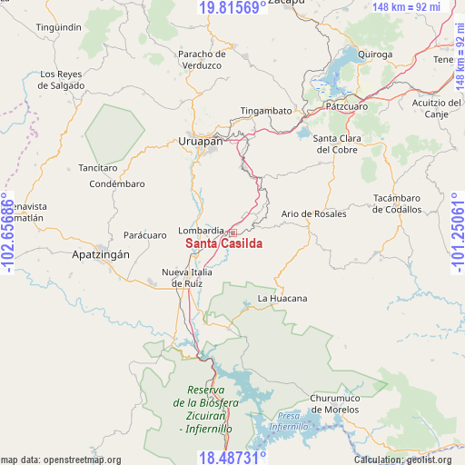
Santa Casilda GPS coordinates[2]
19° 9' 10.224" North, 101° 57' 13.428" West
| Map corner | latitude | longitude |
|---|---|---|
| Upper-left | 19.81569°, | -102.65686° |
| Center: | 19.15284°, | -101.95373° |
| Lower-right: | 18.48731°, | -101.25061° |
| Map W x H: | 147.7×147.7 km | = 91.8×91.8mi |
| max Lat: | 32.7° ⇑62.1% North |
| Santa Casilda: | 19.15284° |
| min Lat: | ⇓37.9% South 14.53588° |
| min Long | Santa Casilda | max Long |
| -117.105° | -101.95373° | -86.73105° |
| W 19.3%⇐ | ⇒80.7% E |
Elevation
Elevation of Santa Casilda is 452 m = 1483 ft, and this is 801.7 m = 2630 ft below average elevation for this country.
| Max E: |
3497 m = 11473 ft | 69.3% |
| Avg. | 1253.7 m = 4113 ft | |
| Santa Casilda | 452 m = 1483 ft | |
Min E: |
-1 m = -3 ft | 30.7% |
See also: Mexico elevation on elevation.city.
Geographical zone
Santa Casilda is located in North Torrid zone (between Equator and Tropic of Cancer). Distance of this Northern Tropic circle is 476.3 km =296 mi to North.| Distance of | km | miles | from Santa Casilda |
|---|---|---|---|
| North Pole | 7877.5 | 4894.9 | to North |
| Arctic Circle | 5271.6 | 3275.6 | to North |
| Tropic Cancer | 476.3 | 296 | to North |
| Equator | 2129.6 | 1323.3 | to South |


Nearby cities:
15 places around Santa Casilda: (largest is in red/bold)
• Charapendo
17.1 km =10.6 mi,  316°
316°
• El Caulote
19 km =11.8 mi,  260°
260°
• El Guaco
14.5 km =9 mi,  228°
228°
• El Sabino
15.6 km =9.7 mi,  353°
353°
• Estación Nueva Italia
16.9 km =10.5 mi,  235°
235°
• La Ibérica (La Gotera)
4.2 km =2.6 mi,  71°
71°
• La Purísima
18.4 km =11.4 mi,  20°
20°
• Lombardía
10.2 km =6.3 mi,  273°
273°
• Los Cajones
7.6 km =4.7 mi,  33°
33°
• Los Otates
13.5 km =8.4 mi,  81°
81°
• Nuevo Urecho
9.1 km =5.7 mi, 80°
• San Vicente
17.8 km =11.1 mi,  39°
39°
• Tahuejo
18.5 km =11.5 mi,  358°
358°
• Tomendán
20.2 km =12.6 mi, 29°
• Villa Eréndira
7 km =4.3 mi, 69°
Sources, notices
• [Note1] Compared only with cities in Mexico existing in our database
• [Src1] Map data: © OpenStreetMap contributors (CC-BY-SA)
• [Src2] Other city data from geonames.org with taken over terms of usage.
• [Src3] Geographical zone / Annual Mean Temperature by Robert A. Rohde @ Wikipedia
