Nuevo Galeana geodata
Nuevo Galeana (Guerrero) is a populated place; located in Mexico in America/Mexico_City (GMT-6) time zone. With population of 778 people, there are 11229 cities with bigger population in this country. Compared to other cities in Mexico, 72% of cities are located further ↑North; 70.5% of cities are located further →East and 72.3% of cities have higher elevation than Nuevo Galeana. Note1


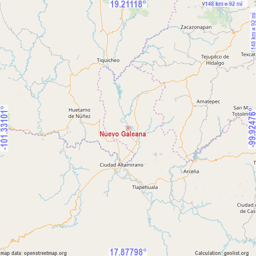
Nuevo Galeana GPS coordinates[2]
18° 32' 45.168" North, 100° 37' 40.368" West
| Map corner | latitude | longitude |
|---|---|---|
| Upper-left | 19.21118°, | -101.33101° |
| Center: | 18.54588°, | -100.62788° |
| Lower-right: | 17.87798°, | -99.92476° |
| Map W x H: | 148.2×148.2 km | = 92.1×92.1mi |
| max Lat: | 32.7° ⇑72% North |
| Nuevo Galeana: | 18.54588° |
| min Lat: | ⇓28% South 14.53588° |
| min Long | Nuevo Galeana | max Long |
| -117.105° | -100.62788° | -86.73105° |
| W 29.5%⇐ | ⇒70.5% E |
Elevation
Elevation of Nuevo Galeana is 319 m = 1047 ft, and this is 934.7 m = 3067 ft below average elevation for this country.
| Max E: |
3497 m = 11473 ft | 72.3% |
| Avg. | 1253.7 m = 4113 ft | |
| Nuevo Galeana | 319 m = 1047 ft | |
Min E: |
-1 m = -3 ft | 27.7% |
See also: Mexico elevation on elevation.city.
Geographical zone
Nuevo Galeana is located in North Torrid zone (between Equator and Tropic of Cancer). Distance of this Northern Tropic circle is 543.8 km =337.9 mi to North.| Distance of | km | miles | from Nuevo Galeana |
|---|---|---|---|
| North Pole | 7945 | 4936.8 | to North |
| Arctic Circle | 5339.1 | 3317.6 | to North |
| Tropic Cancer | 543.8 | 337.9 | to North |
| Equator | 2062.1 | 1281.3 | to South |


Nearby cities:
15 places around Nuevo Galeana: (largest is in red/bold)
• Arroyo Grande
16.3 km =10.1 mi,  335°
335°
• Cuadrilla Nueva
13.9 km =8.6 mi,  154°
154°
• Cutzamala de Pinzón
10 km =6.2 mi, 150°
• El Salitre (Sirapitiro)
7.2 km =4.5 mi,  41°
41°
• La Bolsa
16.8 km =10.4 mi,  168°
168°
• Otlatepec (Agua del Padre)
14.2 km =8.8 mi,  106°
106°
• Río Florido (Las Ánimas)
19.7 km =12.2 mi,  203°
203°
• Salguero
14.7 km =9.1 mi,  179°
179°
• San Jerónimo
19 km =11.8 mi,  194°
194°
• San Lucas
17.3 km =10.7 mi,  286°
286°
• Santa Cruz de Villa Gómez
19 km =11.8 mi, 180°
• Santo Domingo
19.2 km =11.9 mi,  213°
213°
• Tacupa
16.3 km =10.1 mi, 200°
• Tamácuaro
6.2 km =3.9 mi, 204°
• Zacapuato
13.8 km =8.6 mi,  9°
9°
Sources, notices
• [Note1] Compared only with cities in Mexico existing in our database
• [Src1] Map data: © OpenStreetMap contributors (CC-BY-SA)
• [Src2] Other city data from geonames.org with taken over terms of usage.
• [Src3] Geographical zone / Annual Mean Temperature by Robert A. Rohde @ Wikipedia
