Taixtan geodata
Taixtan (Michoacán) is a populated locality; located in Mexico in America/Mexico_City (GMT-6) time zone. With population of 755 people, there are 11595 cities with bigger population in this country. Compared to other cities in Mexico, 63.9% of cities are located further ↑North; 85.5% of cities are located further →East and 69.7% of cities have higher elevation than Taixtan. Note1


Taixtan GPS coordinates[2]
19° 2' 43.476" North, 102° 55' 6.456" West
| Map corner | latitude | longitude |
|---|---|---|
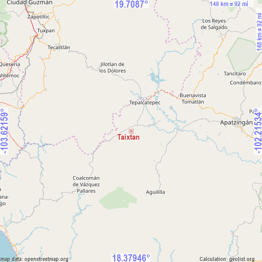
| Upper-left | 19.7087°, | -103.62159° |
| Center: | 19.04541°, | -102.91846° |
| Lower-right: | 18.37946°, | -102.21534° |
| Map W x H: | 147.8×147.8 km | = 91.8×91.8mi |
| max Lat: | 32.7° ⇑63.9% North |
| Taixtan: | 19.04541° |
| min Lat: | ⇓36.1% South 14.53588° |
| min Long | Taixtan | max Long |
| -117.105° | -102.91846° | -86.73105° |
| W 14.5%⇐ | ⇒85.5% E |
Elevation
Elevation of Taixtan is 432 m = 1417 ft, and this is 821.7 m = 2696 ft below average elevation for this country.
| Max E: |
3497 m = 11473 ft | 69.7% |
| Avg. | 1253.7 m = 4113 ft | |
| Taixtan | 432 m = 1417 ft | |
Min E: |
-1 m = -3 ft | 30.3% |
See also: Mexico elevation on elevation.city.
Geographical zone
Taixtan is located in North Torrid zone (between Equator and Tropic of Cancer). Distance of this Northern Tropic circle is 488.3 km =303.4 mi to North.| Distance of | km | miles | from Taixtan |
|---|---|---|---|
| North Pole | 7889.4 | 4902.2 | to North |
| Arctic Circle | 5283.5 | 3283 | to North |
| Tropic Cancer | 488.3 | 303.4 | to North |
| Equator | 2117.7 | 1315.9 | to South |


Nearby cities:
15 places around Taixtan: (largest is in red/bold)
• Aguililla
36.8 km =22.9 mi,  158°
158°
• Bonifacio Moreno (El Aguaje)
22.6 km =14 mi,  105°
105°
• Buenavistilla (La Garita)
30.9 km =19.2 mi,  81°
81°
• Dieciocho de Marzo
30.4 km =18.9 mi,  47°
47°
• División del Norte
32.4 km =20.1 mi, 82°
• Dos Aguas
26.5 km =16.5 mi,  181°
181°
• El Naranjo de Chila
34.1 km =21.2 mi, 113°
• El Terrero
28.3 km =17.6 mi,  88°
88°
• Felipe Carrillo Puerto
25.7 km =16 mi,  59°
59°
• Jilotlán de los Dolores
37.7 km =23.4 mi,  343°
343°
• Loma Blanca
13.2 km =8.2 mi,  73°
73°
• Los Olivos
19 km =11.8 mi,  18°
18°
• Punta del Agua
27 km =16.8 mi, 78°
• Rancho Nuevo
37 km =23 mi,  37°
37°
• Tepalcatepec
17.3 km =10.7 mi, 24°
Sources, notices
• [Note1] Compared only with cities in Mexico existing in our database
• [Src1] Map data: © OpenStreetMap contributors (CC-BY-SA)
• [Src2] Other city data from geonames.org with taken over terms of usage.
• [Src3] Geographical zone / Annual Mean Temperature by Robert A. Rohde @ Wikipedia
