Tepalcatepec geodata
Tepalcatepec (Michoacán) is a seat of a second-order administrative division; located in Mexico in America/Mexico_City (GMT-6) time zone. With population of 15,221 people, there are 632 cities with bigger population in this country. Compared to other cities in Mexico, 61.5% of cities are located further ↑North; 85.3% of cities are located further →East and 70.4% of cities have higher elevation than Tepalcatepec. Note1


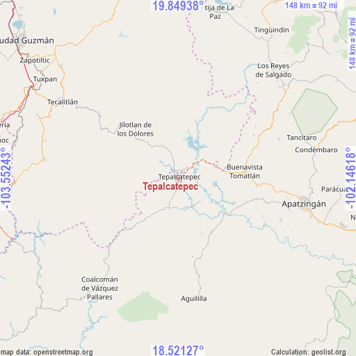
Tepalcatepec GPS coordinates[2]
19° 11' 11.976" North, 102° 50' 57.48" West
| Map corner | latitude | longitude |
|---|---|---|
| Upper-left | 19.84938°, | -103.55243° |
| Center: | 19.18666°, | -102.8493° |
| Lower-right: | 18.52127°, | -102.14618° |
| Map W x H: | 147.7×147.7 km | = 91.8×91.8mi |
| max Lat: | 32.7° ⇑61.5% North |
| Tepalcatepec: | 19.18666° |
| min Lat: | ⇓38.5% South 14.53588° |
| min Long | Tepalcatepec | max Long |
| -117.105° | -102.8493° | -86.73105° |
| W 14.7%⇐ | ⇒85.3% E |
Elevation
Elevation of Tepalcatepec is 397 m = 1302 ft, and this is 856.7 m = 2811 ft below average elevation for this country.
| Max E: |
3497 m = 11473 ft | 70.4% |
| Avg. | 1253.7 m = 4113 ft | |
| Tepalcatepec | 397 m = 1302 ft | |
Min E: |
-1 m = -3 ft | 29.6% |
See also: Mexico elevation on elevation.city.
Geographical zone
Tepalcatepec is located in North Torrid zone (between Equator and Tropic of Cancer). Distance of this Northern Tropic circle is 472.6 km =293.7 mi to North.| Distance of | km | miles | from Tepalcatepec |
|---|---|---|---|
| North Pole | 7873.7 | 4892.5 | to North |
| Arctic Circle | 5267.8 | 3273.3 | to North |
| Tropic Cancer | 472.6 | 293.7 | to North |
| Equator | 2133.4 | 1325.6 | to South |


Nearby cities:
15 places around Tepalcatepec: (largest is in red/bold)
• Bonifacio Moreno (El Aguaje)
26.1 km =16.2 mi,  146°
146°
• Buenavista Tomatlán
27.7 km =17.2 mi,  83°
83°
• Buenavistilla (La Garita)
25.7 km =16 mi,  115°
115°
• Dieciocho de Marzo
15.9 km =9.9 mi,  71°
71°
• División del Norte
27.5 km =17.1 mi, 115°
• El Terrero
25.8 km =16 mi,  125°
125°
• Felipe Carrillo Puerto
15 km =9.3 mi,  99°
99°
• Jilotlán de los Dolores
27.2 km =16.9 mi,  318°
318°
• Loma Blanca
13.1 km =8.1 mi,  155°
155°
• Los Olivos
2.7 km =1.7 mi,  330°
330°
• Punta del Agua
21.7 km =13.5 mi, 118°
• Rancho Nuevo
20.5 km =12.7 mi,  47°
47°
• Santa Ana Amatlán
32.5 km =20.2 mi, 95°
• Taixtan
17.3 km =10.7 mi,  204°
204°
• Tazumbo
24.5 km =15.2 mi,  60°
60°
Sources, notices
• [Note1] Compared only with cities in Mexico existing in our database
• [Src1] Map data: © OpenStreetMap contributors (CC-BY-SA)
• [Src2] Other city data from geonames.org with taken over terms of usage.
• [Src3] Geographical zone / Annual Mean Temperature by Robert A. Rohde @ Wikipedia
