El Oriente geodata
El Oriente (Veracruz) is a populated place; located in Mexico in America/Mexico_City (GMT-6) time zone. With population of 504 people, there are 16693 cities with bigger population in this country. Compared to other cities in Mexico, 72.5% of cities are located further ↓South; 69.4% of cities are located further ←West and 78.8% of cities have higher elevation than El Oriente. Note1


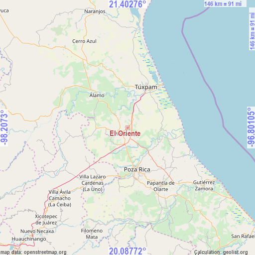
El Oriente GPS coordinates[2]
20° 44' 48.012" North, 97° 30' 15.012" West
| Map corner | latitude | longitude |
|---|---|---|
| Upper-left | 21.40276°, | -98.2073° |
| Center: | 20.74667°, | -97.50417° |
| Lower-right: | 20.08772°, | -96.80105° |
| Map W x H: | 146.2×146.2 km | = 90.8×90.8mi |
| max Lat: | 32.7° ⇑27.5% North |
| El Oriente: | 20.74667° |
| min Lat: | ⇓72.5% South 14.53588° |
| min Long | El Oriente | max Long |
| -117.105° | -97.50417° | -86.73105° |
| W 69.4%⇐ | ⇒30.6% E |
Elevation
Elevation of El Oriente is 115 m = 377 ft, and this is 1138.7 m = 3736 ft below average elevation for this country.
| Max E: |
3497 m = 11473 ft | 78.8% |
| Avg. | 1253.7 m = 4113 ft | |
| El Oriente | 115 m = 377 ft | |
Min E: |
-1 m = -3 ft | 21.2% |
See also: Mexico elevation on elevation.city.
Geographical zone
El Oriente is located in North Torrid zone (between Equator and Tropic of Cancer). Distance of this Northern Tropic circle is 299.1 km =185.9 mi to North.| Distance of | km | miles | from El Oriente |
|---|---|---|---|
| North Pole | 7700.2 | 4784.7 | to North |
| Arctic Circle | 5094.4 | 3165.5 | to North |
| Tropic Cancer | 299.1 | 185.9 | to North |
| Equator | 2306.8 | 1433.4 | to South |


Nearby cities:
15 places around El Oriente: (largest is in red/bold)
• Castillo de Teayo
13.1 km =8.1 mi,  271°
271°
• Cañada Rica
9 km =5.6 mi,  18°
18°
• Chichimantla Segundo
6.1 km =3.8 mi,  141°
141°
• El Salto de la Reforma
14.3 km =8.9 mi,  69°
69°
• El Terrero
7.3 km =4.5 mi,  324°
324°
• El Águila
13.8 km =8.6 mi,  158°
158°
• Enrique Rodríguez Cano (Zapotalillo)
10.7 km =6.6 mi,  205°
205°
• Francisco Villa
7.8 km =4.8 mi,  310°
310°
• Jiliapa Segundo
12 km =7.5 mi,  236°
236°
• La Granadilla
11.9 km =7.4 mi,  325°
325°
• Laja del Tubo
12.8 km =8 mi,  79°
79°
• Lima Vieja
14 km =8.7 mi,  289°
289°
• Nuevo Tejamanil
11.9 km =7.4 mi,  102°
102°
• Tecomate
6.1 km =3.8 mi,  302°
302°
• Tihuatlan
4.7 km =2.9 mi,  220°
220°
Sources, notices
• [Note1] Compared only with cities in Mexico existing in our database
• [Src1] Map data: © OpenStreetMap contributors (CC-BY-SA)
• [Src2] Other city data from geonames.org with taken over terms of usage.
• [Src3] Geographical zone / Annual Mean Temperature by Robert A. Rohde @ Wikipedia
