Plan de los Mangos geodata
Plan de los Mangos (Veracruz) is a populated place; located in Mexico in America/Mexico_City (GMT-6) time zone. With population of 540 people, there are 15727 cities with bigger population in this country. Compared to other cities in Mexico, 69.1% of cities are located further ↓South; 71.2% of cities are located further ←West and 78.6% of cities have higher elevation than Plan de los Mangos. Note1


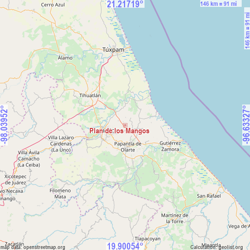
Plan de los Mangos GPS coordinates[2]
20° 33' 37.008" North, 97° 20' 11.004" West
| Map corner | latitude | longitude |
|---|---|---|
| Upper-left | 21.21719°, | -98.03952° |
| Center: | 20.56028°, | -97.33639° |
| Lower-right: | 19.90054°, | -96.63327° |
| Map W x H: | 146.4×146.4 km | = 91×91mi |
| max Lat: | 32.7° ⇑30.9% North |
| Plan de los Mangos: | 20.56028° |
| min Lat: | ⇓69.1% South 14.53588° |
| min Long | Plan de los Man | max Long |
| -117.105° | -97.33639° | -86.73105° |
| W 71.2%⇐ | ⇒28.8% E |
Elevation
Elevation of Plan de los Mangos is 118 m = 387 ft, and this is 1135.7 m = 3726 ft below average elevation for this country.
| Max E: |
3497 m = 11473 ft | 78.6% |
| Avg. | 1253.7 m = 4113 ft | |
| Plan de los Mangos | 118 m = 387 ft | |
Min E: |
-1 m = -3 ft | 21.4% |
See also: Mexico elevation on elevation.city.
Geographical zone
Plan de los Mangos is located in North Torrid zone (between Equator and Tropic of Cancer). Distance of this Northern Tropic circle is 319.8 km =198.7 mi to North.| Distance of | km | miles | from Plan de los Mangos |
|---|---|---|---|
| North Pole | 7721 | 4797.6 | to North |
| Arctic Circle | 5115.1 | 3178.4 | to North |
| Tropic Cancer | 319.8 | 198.7 | to North |
| Equator | 2286.1 | 1420.5 | to South |


Nearby cities:
15 places around Plan de los Mangos: (largest is in red/bold)
• Adolfo Ruíz Cortines
5.1 km =3.2 mi,  38°
38°
• Arroyo del Maíz Uno
8.6 km =5.3 mi,  252°
252°
• Carrizal
9.2 km =5.7 mi,  64°
64°
• Donato Márquez Azuara
4.8 km =3 mi,  216°
216°
• El Cabellal
3 km =1.9 mi,  238°
238°
• El Mollejon
8 km =5 mi,  255°
255°
• La Grandeza
6.8 km =4.2 mi,  226°
226°
• La Guásima
9.3 km =5.8 mi,  104°
104°
• Polutla
8.8 km =5.5 mi,  113°
113°
• Poza Verde
8.8 km =5.5 mi,  80°
80°
• Reforma Escolín
9.6 km =6 mi,  212°
212°
• Residencial Tajín
9.4 km =5.8 mi,  296°
296°
• Santa Águeda
2.4 km =1.5 mi,  118°
118°
• Sombrerete
4.5 km =2.8 mi,  2°
2°
• Vicente Herrera
2.3 km =1.4 mi,  323°
323°
Sources, notices
• [Note1] Compared only with cities in Mexico existing in our database
• [Src1] Map data: © OpenStreetMap contributors (CC-BY-SA)
• [Src2] Other city data from geonames.org with taken over terms of usage.
• [Src3] Geographical zone / Annual Mean Temperature by Robert A. Rohde @ Wikipedia
