El Lindero geodata
El Lindero (Veracruz) is a populated place; located in Mexico in America/Mexico_City (GMT-6) time zone. With population of 1,123 people, there are 7722 cities with bigger population in this country. Compared to other cities in Mexico, 80.1% of cities are located further ↓South; 61% of cities are located further ←West and 76.3% of cities have higher elevation than El Lindero. Note1


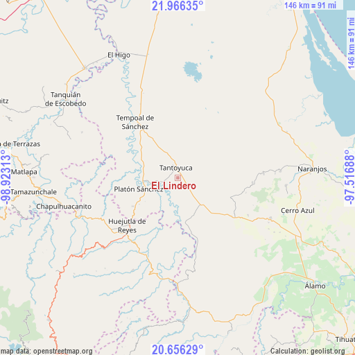
El Lindero GPS coordinates[2]
21° 18' 46.008" North, 98° 13' 12" West
| Map corner | latitude | longitude |
|---|---|---|
| Upper-left | 21.96635°, | -98.92313° |
| Center: | 21.31278°, | -98.22° |
| Lower-right: | 20.65629°, | -97.51688° |
| Map W x H: | 145.7×145.7 km | = 90.5×90.5mi |
| max Lat: | 32.7° ⇑19.9% North |
| El Lindero: | 21.31278° |
| min Lat: | ⇓80.1% South 14.53588° |
| min Long | El Lindero | max Long |
| -117.105° | -98.22° | -86.73105° |
| W 61%⇐ | ⇒39% E |
Elevation
Elevation of El Lindero is 176 m = 577 ft, and this is 1077.7 m = 3536 ft below average elevation for this country.
| Max E: |
3497 m = 11473 ft | 76.3% |
| Avg. | 1253.7 m = 4113 ft | |
| El Lindero | 176 m = 577 ft | |
Min E: |
-1 m = -3 ft | 23.7% |
See also: Mexico elevation on elevation.city.
Geographical zone
El Lindero is located in North Torrid zone (between Equator and Tropic of Cancer). Distance of this Northern Tropic circle is 236.2 km =146.8 mi to North.| Distance of | km | miles | from El Lindero |
|---|---|---|---|
| North Pole | 7637.3 | 4745.6 | to North |
| Arctic Circle | 5031.4 | 3126.4 | to North |
| Tropic Cancer | 236.2 | 146.8 | to North |
| Equator | 2369.8 | 1472.5 | to South |


Nearby cities:
15 places around El Lindero: (largest is in red/bold)
• Callejón Santa Clara
10.2 km =6.3 mi,  113°
113°
• Cerro Botica
11.9 km =7.4 mi,  336°
336°
• Corralillo
6.5 km =4 mi,  176°
176°
• El Jobo Aquiche
12 km =7.5 mi,  315°
315°
• El Mirador
9.2 km =5.7 mi,  169°
169°
• El Porvenir Chopopo
7.9 km =4.9 mi,  38°
38°
• Mezquite Mata del Tigre
10.3 km =6.4 mi,  354°
354°
• Moralillo
2.7 km =1.7 mi,  160°
160°
• Palmar Aquiche Primero
11.9 km =7.4 mi, 322°
• Potrero Segundo
6.9 km =4.3 mi,  311°
311°
• Tametate
1.5 km =0.9 mi,  295°
295°
• Tantoyuca
4.3 km =2.7 mi, 352°
• Tepatlán
5.6 km =3.5 mi,  260°
260°
• Trapiche
8.8 km =5.5 mi, 315°
• Xiloxúchitl
6.5 km =4 mi, 305°
Sources, notices
• [Note1] Compared only with cities in Mexico existing in our database
• [Src1] Map data: © OpenStreetMap contributors (CC-BY-SA)
• [Src2] Other city data from geonames.org with taken over terms of usage.
• [Src3] Geographical zone / Annual Mean Temperature by Robert A. Rohde @ Wikipedia
