Corralillo geodata
Corralillo (Veracruz) is a populated place; located in Mexico in America/Mexico_City (GMT-6) time zone. With population of 624 people, there are 13853 cities with bigger population in this country. Compared to other cities in Mexico, 79.6% of cities are located further ↓South; 61% of cities are located further ←West and 76.6% of cities have higher elevation than Corralillo. Note1


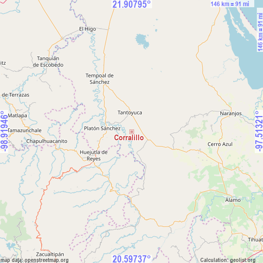
Corralillo GPS coordinates[2]
21° 15' 14.832" North, 98° 12' 58.788" West
| Map corner | latitude | longitude |
|---|---|---|
| Upper-left | 21.90795°, | -98.91946° |
| Center: | 21.25412°, | -98.21633° |
| Lower-right: | 20.59737°, | -97.51321° |
| Map W x H: | 145.7×145.7 km | = 90.5×90.5mi |
| max Lat: | 32.7° ⇑20.4% North |
| Corralillo: | 21.25412° |
| min Lat: | ⇓79.6% South 14.53588° |
| min Long | Corralillo | max Long |
| -117.105° | -98.21633° | -86.73105° |
| W 61%⇐ | ⇒39% E |
Elevation
Elevation of Corralillo is 165 m = 541 ft, and this is 1088.7 m = 3572 ft below average elevation for this country.
| Max E: |
3497 m = 11473 ft | 76.6% |
| Avg. | 1253.7 m = 4113 ft | |
| Corralillo | 165 m = 541 ft | |
Min E: |
-1 m = -3 ft | 23.4% |
See also: Mexico elevation on elevation.city.
Geographical zone
Corralillo is located in North Torrid zone (between Equator and Tropic of Cancer). Distance of this Northern Tropic circle is 242.7 km =150.8 mi to North.| Distance of | km | miles | from Corralillo |
|---|---|---|---|
| North Pole | 7643.8 | 4749.6 | to North |
| Arctic Circle | 5037.9 | 3130.4 | to North |
| Tropic Cancer | 242.7 | 150.8 | to North |
| Equator | 2363.2 | 1468.4 | to South |


Nearby cities:
15 places around Corralillo: (largest is in red/bold)
• Callejón Santa Clara
9.3 km =5.8 mi,  74°
74°
• Chapopote Chico
13.4 km =8.3 mi,  194°
194°
• El Lindero
6.5 km =4 mi,  356°
356°
• El Mirador
2.8 km =1.7 mi,  151°
151°
• El Porvenir Chopopo
13.5 km =8.4 mi,  19°
19°
• Ixcanelco
13 km =8.1 mi,  169°
169°
• Los Ajos
10.1 km =6.3 mi,  132°
132°
• Moralillo
4 km =2.5 mi,  7°
7°
• Potrero Segundo
12.4 km =7.7 mi,  333°
333°
• San Diego
12.2 km =7.6 mi, 167°
• San Sebastián
9.6 km =6 mi,  115°
115°
• Tametate
7.4 km =4.6 mi,  346°
346°
• Tantoyuca
10.8 km =6.7 mi, 354°
• Tepatlán
8.1 km =5 mi,  313°
313°
• Xiloxúchitl
11.8 km =7.3 mi, 331°
Sources, notices
• [Note1] Compared only with cities in Mexico existing in our database
• [Src1] Map data: © OpenStreetMap contributors (CC-BY-SA)
• [Src2] Other city data from geonames.org with taken over terms of usage.
• [Src3] Geographical zone / Annual Mean Temperature by Robert A. Rohde @ Wikipedia
