Moralillo geodata
Moralillo (Veracruz) is a populated place; located in Mexico in America/Mexico_City (GMT-6) time zone. With population of 804 people, there are 10860 cities with bigger population in this country. Compared to other cities in Mexico, 79.9% of cities are located further ↓South; 61.1% of cities are located further ←West and 77.5% of cities have higher elevation than Moralillo. Note1


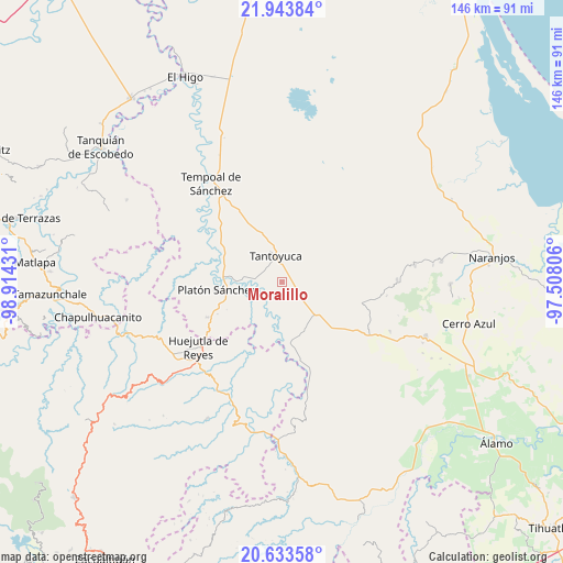
Moralillo GPS coordinates[2]
21° 17' 24.612" North, 98° 12' 40.248" West
| Map corner | latitude | longitude |
|---|---|---|
| Upper-left | 21.94384°, | -98.91431° |
| Center: | 21.29017°, | -98.21118° |
| Lower-right: | 20.63358°, | -97.50806° |
| Map W x H: | 145.7×145.7 km | = 90.5×90.5mi |
| max Lat: | 32.7° ⇑20.1% North |
| Moralillo: | 21.29017° |
| min Lat: | ⇓79.9% South 14.53588° |
| min Long | Moralillo | max Long |
| -117.105° | -98.21118° | -86.73105° |
| W 61.1%⇐ | ⇒38.9% E |
Elevation
Elevation of Moralillo is 141 m = 463 ft, and this is 1112.7 m = 3651 ft below average elevation for this country.
| Max E: |
3497 m = 11473 ft | 77.5% |
| Avg. | 1253.7 m = 4113 ft | |
| Moralillo | 141 m = 463 ft | |
Min E: |
-1 m = -3 ft | 22.5% |
See also: Mexico elevation on elevation.city.
Geographical zone
Moralillo is located in North Torrid zone (between Equator and Tropic of Cancer). Distance of this Northern Tropic circle is 238.7 km =148.3 mi to North.| Distance of | km | miles | from Moralillo |
|---|---|---|---|
| North Pole | 7639.8 | 4747.2 | to North |
| Arctic Circle | 5033.9 | 3127.9 | to North |
| Tropic Cancer | 238.7 | 148.3 | to North |
| Equator | 2367.2 | 1470.9 | to South |


Nearby cities:
15 places around Moralillo: (largest is in red/bold)
• Callejón Santa Clara
8.5 km =5.3 mi,  100°
100°
• Corralillo
4 km =2.5 mi,  187°
187°
• El Lindero
2.7 km =1.7 mi,  340°
340°
• El Mirador
6.6 km =4.1 mi,  172°
172°
• El Porvenir Chopopo
9.6 km =6 mi,  24°
24°
• Los Ajos
12.8 km =8 mi,  147°
147°
• Mezquite Mata del Tigre
12.9 km =8 mi,  351°
351°
• Palmar Aquiche Primero
14.4 km =8.9 mi,  325°
325°
• Potrero Segundo
9.3 km =5.8 mi,  319°
319°
• San Sebastián
11.5 km =7.1 mi,  134°
134°
• Tametate
3.9 km =2.4 mi, 324°
• Tantoyuca
6.9 km =4.3 mi, 347°
• Tepatlán
6.6 km =4.1 mi,  283°
283°
• Trapiche
11.3 km =7 mi, 321°
• Xiloxúchitl
8.9 km =5.5 mi, 315°
Sources, notices
• [Note1] Compared only with cities in Mexico existing in our database
• [Src1] Map data: © OpenStreetMap contributors (CC-BY-SA)
• [Src2] Other city data from geonames.org with taken over terms of usage.
• [Src3] Geographical zone / Annual Mean Temperature by Robert A. Rohde @ Wikipedia
