Apatauyan geodata
Apatauyan (Puebla) is a populated place; located in Mexico in America/Mexico_City (GMT-6) time zone. With population of 1,700 people, there are 5110 cities with bigger population in this country. Compared to other cities in Mexico, 52.8% of cities are located further ↓South; 70.1% of cities are located further ←West and 81.3% of cities have lower elevation than Apatauyan. Note1


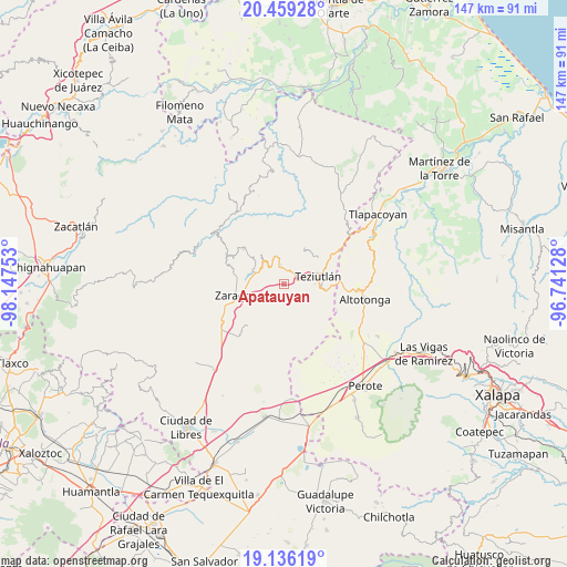
Apatauyan GPS coordinates[2]
19° 47' 56.796" North, 97° 26' 39.84" West
| Map corner | latitude | longitude |
|---|---|---|
| Upper-left | 20.45928°, | -98.14753° |
| Center: | 19.79911°, | -97.4444° |
| Lower-right: | 19.13619°, | -96.74128° |
| Map W x H: | 147.1×147.1 km | = 91.4×91.4mi |
| max Lat: | 32.7° ⇑47.2% North |
| Apatauyan: | 19.79911° |
| min Lat: | ⇓52.8% South 14.53588° |
| min Long | Apatauyan | max Long |
| -117.105° | -97.4444° | -86.73105° |
| W 70.1%⇐ | ⇒29.9% E |
Elevation
Elevation of Apatauyan is 2172 m = 7126 ft, and this is 918.3 m = 3013 ft above average elevation for this country.
| Max E: |
3497 m = 11473 ft | 18.7% |
| Apatauyan | 2172 m 7126 ft | |
| Avg. | 1253.7 m = 4113 ft | |
Min E: |
-1 m = -3 ft | 81.3% |
See also: Mexico elevation on elevation.city.
Geographical zone
Apatauyan is located in North Torrid zone (between Equator and Tropic of Cancer). Distance of this Northern Tropic circle is 404.5 km =251.3 mi to North.| Distance of | km | miles | from Apatauyan |
|---|---|---|---|
| North Pole | 7805.6 | 4850.2 | to North |
| Arctic Circle | 5199.7 | 3230.9 | to North |
| Tropic Cancer | 404.5 | 251.3 | to North |
| Equator | 2201.5 | 1367.9 | to South |


Nearby cities:
15 places around Apatauyan: (largest is in red/bold)
• Ajocotzingo
4.3 km =2.7 mi,  295°
295°
• Atempan
4.7 km =2.9 mi,  341°
341°
• Atioyan
3.3 km =2.1 mi,  230°
230°
• Atzalán
2.8 km =1.7 mi,  0°
0°
• Cala Sur
4.5 km =2.8 mi,  33°
33°
• Coahuixco
3.6 km =2.2 mi,  78°
78°
• Gómez Oriente
4.5 km =2.8 mi,  237°
237°
• Las Canoas
1.8 km =1.1 mi,  355°
355°
• Las Delicias
4.3 km =2.7 mi, 356°
• Pablogco
4.3 km =2.7 mi,  273°
273°
• San Ambrosio
2.3 km =1.4 mi,  354°
354°
• Tacopan
4.5 km =2.8 mi,  18°
18°
• Talzintán
3 km =1.9 mi,  91°
91°
• Tanhuixco
3.4 km =2.1 mi,  314°
314°
• Tezhuatepec
2.4 km =1.5 mi, 306°
Sources, notices
• [Note1] Compared only with cities in Mexico existing in our database
• [Src1] Map data: © OpenStreetMap contributors (CC-BY-SA)
• [Src2] Other city data from geonames.org with taken over terms of usage.
• [Src3] Geographical zone / Annual Mean Temperature by Robert A. Rohde @ Wikipedia
