Tlaltempanapa geodata
Tlaltempanapa (Guerrero) is a populated place; located in Mexico in America/Mexico_City (GMT-6) time zone. With population of 1,517 people, there are 5684 cities with bigger population in this country. Compared to other cities in Mexico, 81.1% of cities are located further ↑North; 52.3% of cities are located further →East and 50.6% of cities have higher elevation than Tlaltempanapa. Note1


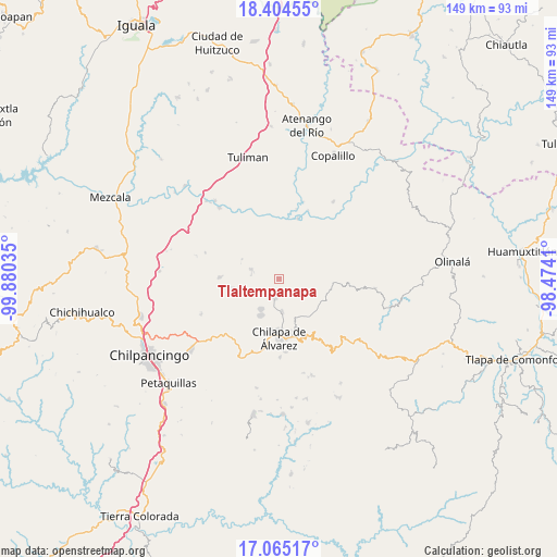
Tlaltempanapa GPS coordinates[2]
17° 44' 9.996" North, 99° 10' 37.992" West
| Map corner | latitude | longitude |
|---|---|---|
| Upper-left | 18.40455°, | -99.88035° |
| Center: | 17.73611°, | -99.17722° |
| Lower-right: | 17.06517°, | -98.4741° |
| Map W x H: | 148.9×148.9 km | = 92.5×92.5mi |
| max Lat: | 32.7° ⇑81.1% North |
| Tlaltempanapa: | 17.73611° |
| min Lat: | ⇓18.9% South 14.53588° |
| min Long | Tlaltempanapa | max Long |
| -117.105° | -99.17722° | -86.73105° |
| W 47.7%⇐ | ⇒52.3% E |
Elevation
Elevation of Tlaltempanapa is 1400 m = 4593 ft, and this is 146.3 m = 480 ft above average elevation for this country.
| Max E: |
3497 m = 11473 ft | 50.6% |
| Tlaltempanapa | 1400 m 4593 ft | |
| Avg. | 1253.7 m = 4113 ft | |
Min E: |
-1 m = -3 ft | 49.4% |
See also: Mexico elevation on elevation.city.
Geographical zone
Tlaltempanapa is located in North Torrid zone (between Equator and Tropic of Cancer). Distance of this Northern Tropic circle is 633.8 km =393.8 mi to North.| Distance of | km | miles | from Tlaltempanapa |
|---|---|---|---|
| North Pole | 8035 | 4992.7 | to North |
| Arctic Circle | 5429.1 | 3373.5 | to North |
| Tropic Cancer | 633.8 | 393.8 | to North |
| Equator | 1972.1 | 1225.4 | to South |


Nearby cities:
15 places around Tlaltempanapa: (largest is in red/bold)
• Acatlán
8.7 km =5.4 mi,  174°
174°
• Ajuatetla
12 km =7.5 mi,  65°
65°
• Ayotzinapa
6.9 km =4.3 mi,  251°
251°
• La Esperanza
7.9 km =4.9 mi,  289°
289°
• La Mohonera
11.2 km =7 mi,  193°
193°
• Las Trancas
6 km =3.7 mi,  236°
236°
• Los Magueyes
12 km =7.5 mi,  177°
177°
• Mazatepec
9 km =5.6 mi,  207°
207°
• Pochahuizco
9.3 km =5.8 mi, 211°
• Rancho de las Lomas
7.3 km =4.5 mi,  273°
273°
• Santa Catarina (Santa Catarina las Joyas)
9.2 km =5.7 mi,  80°
80°
• Santa Cruz
11.4 km =7.1 mi,  147°
147°
• Topiltepec
10.7 km =6.6 mi, 206°
• Yetlancingo
6.8 km =4.2 mi,  104°
104°
• Zitlala
5.2 km =3.2 mi, 190°
Sources, notices
• [Note1] Compared only with cities in Mexico existing in our database
• [Src1] Map data: © OpenStreetMap contributors (CC-BY-SA)
• [Src2] Other city data from geonames.org with taken over terms of usage.
• [Src3] Geographical zone / Annual Mean Temperature by Robert A. Rohde @ Wikipedia
