Rancho de las Lomas geodata
Rancho de las Lomas (Guerrero) is a populated place; located in Mexico in America/Mexico_City (GMT-6) time zone. With population of 1,232 people, there are 7045 cities with bigger population in this country. Compared to other cities in Mexico, 81% of cities are located further ↑North; 53.6% of cities are located further →East and 55.4% of cities have lower elevation than Rancho de las Lomas. Note1


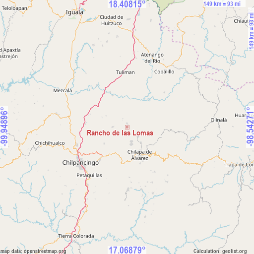
Rancho de las Lomas GPS coordinates[2]
17° 44' 22.992" North, 99° 14' 44.988" West
| Map corner | latitude | longitude |
|---|---|---|
| Upper-left | 18.40815°, | -99.94896° |
| Center: | 17.73972°, | -99.24583° |
| Lower-right: | 17.06879°, | -98.54271° |
| Map W x H: | 148.9×148.9 km | = 92.5×92.5mi |
| max Lat: | 32.7° ⇑81% North |
| Rancho de las Lomas: | 17.73972° |
| min Lat: | ⇓19% South 14.53588° |
| min Long | Rancho de las L | max Long |
| -117.105° | -99.24583° | -86.73105° |
| W 46.4%⇐ | ⇒53.6% E |
Elevation
Elevation of Rancho de las Lomas is 1600 m = 5249 ft, and this is 346.3 m = 1136 ft above average elevation for this country.
| Max E: |
3497 m = 11473 ft | 44.6% |
| Rancho de las Lomas | 1600 m 5249 ft | |
| Avg. | 1253.7 m = 4113 ft | |
Min E: |
-1 m = -3 ft | 55.4% |
See also: Mexico elevation on elevation.city.
Geographical zone
Rancho de las Lomas is located in North Torrid zone (between Equator and Tropic of Cancer). Distance of this Northern Tropic circle is 633.4 km =393.6 mi to North.| Distance of | km | miles | from Rancho de las Lomas |
|---|---|---|---|
| North Pole | 8034.6 | 4992.5 | to North |
| Arctic Circle | 5428.7 | 3373.2 | to North |
| Tropic Cancer | 633.4 | 393.6 | to North |
| Equator | 1972.5 | 1225.7 | to South |


Nearby cities:
15 places around Rancho de las Lomas: (largest is in red/bold)
• Acatlán
12.2 km =7.6 mi,  138°
138°
• Ahuihuiyuco
12.4 km =7.7 mi,  170°
170°
• Almolonga
12.4 km =7.7 mi,  204°
204°
• Apango
8.8 km =5.5 mi,  271°
271°
• Ayotzinapa
2.7 km =1.7 mi,  164°
164°
• Hueyitlalpan
8.9 km =5.5 mi,  216°
216°
• La Esperanza
2.3 km =1.4 mi,  356°
356°
• La Mohonera
12.2 km =7.6 mi, 157°
• Las Trancas
4.4 km =2.7 mi,  149°
149°
• Mazatepec
8.9 km =5.5 mi, 160°
• Pochahuizco
8.7 km =5.4 mi, 163°
• Tlaltempanapa
7.3 km =4.5 mi,  93°
93°
• Topiltepec
10.2 km =6.3 mi, 166°
• Zitlala
8.3 km =5.2 mi,  131°
131°
• Zotoltitlán
5.6 km =3.5 mi,  239°
239°
Sources, notices
• [Note1] Compared only with cities in Mexico existing in our database
• [Src1] Map data: © OpenStreetMap contributors (CC-BY-SA)
• [Src2] Other city data from geonames.org with taken over terms of usage.
• [Src3] Geographical zone / Annual Mean Temperature by Robert A. Rohde @ Wikipedia
